Showing posts with label Hiking. Show all posts

Sunday, September 13, 2015

Possum Walk Trail near Pearlington, MS to reopen soon upgraded for bicycles with fat tires. 5k and 10k set for October 10.

The beginning of the Possum Walk Trail before it was resurfaced with stone.  This is the north end of the trail.  It begins at the west end of the parking lot of the Infinity Space Center next to the Mississippi Visitors Center at the I-10 #2 exit near Waveland, MS.
(Note: As of October 3 crushed stone has been spread on most of the trail but the grind of the stone is too large.  Cyclists will find it difficult to ride the new stone surface as the loose rock makes it easy to lose traction and fall.)
      
       For years the forested lowlands, wetlands and swamps in the southwest corner of Hancock County, Mississippi have attracted birdwatchers flocking to catch a glimpse of acrobatic swallow-tailed kites or tiny, and tuneful electric yellow prothonotary warblers.
       The Logtown Cemetery, on Logtown Rd, south of I-10 is birding ground zero in the county and attracts the birding faithful from around the U.S.  It is one of 40 birding sites listed on the Mississippi Coastal Birding Trail, sponsored by the National Audubon Society.  The trail was established by widely respected birder, the late Judith Toups and includes sites in six of the southernmost counties in Mississippi. (www.mscoastbirdingtrail.audubon.org.)
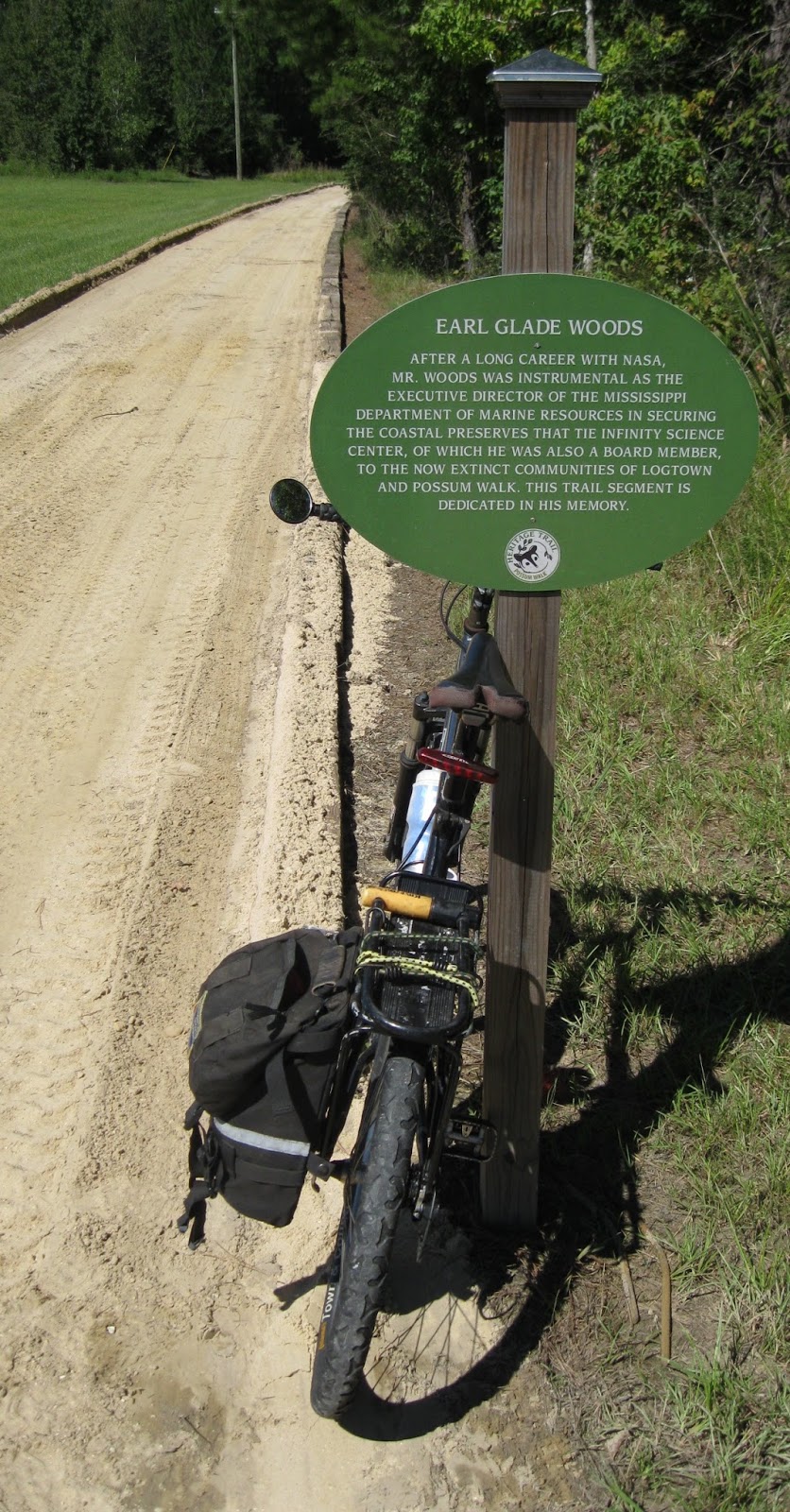
        A year ago the cemetery grounds became the southern terminus of the Possum Walk Trail: an improved and graded dirt trail extending north about 3.2 miles to the Infinity Science Center adjacent to the Mississippi Visitor Center off I-10 at exit #2.  The trail passes through a mix of habitats: southern mixed hardwood forest, bottomland hardwood forest and cypress swamp.  A boardwalk and bridge cross over the swamp and the Bogue Homa.  A handicap accessible kayak launch is at the bridge.
      As this is being written, the dirt trail is being resurfaced with crushed stone to prepare it for electric trams that will carry tourists from the Infinity Science Center on nature treks..  Work should finish and the trail reopen by early October 2015.  In addition to walkers, hikers, runners and the trail is open to pet owners (as long as the pets are on leashes shorter than eight feet and owners deposit their pet's waste in garbage containers) and equestrians who are required to clean up waste left by their horses.  Also electric carts are permitted.  Bicyclists, even through riding bicycles with fat tires will probably find the crushed stone too lose making it possible for a cyclist to loose traction and fall while riding the trail.
         The terrain is flat; the trail mostly follows an old dummyline railroad grade.  Short railroads of a few miles or so were often built by lumber companies to haul harvested trees to the mills to be sawed into lumber.  Some say they were called "dummylines" because logging employees often rode them along with the cut trees.
        (The parking lot forthe Possum Walk Trail end at Infinity Science Center, generally opens at 7 a.m. and closes at 5 p.m.  The lot, the Science Center and that end of the trail is closed on Sunday.  The hours of the Infinity Science Center are from 9am to 4 pm., Monday-Saturday; closed on Sunday.  Admission.)
         However, the Logtown Cemetery end of the trail, is open sunrise to sunset, seven days a week.  Park by pulling off the dirt road at the cemetery and walk .3 miles west on Logtown Rd.to the beginning of the boardwalk.  This short stretch of Logtown Rd. is lovely and mostly in the shade of huge ancient live oaks.  There is room at the boardwalk for a couple of cars to pull off the road but parking here is not encouraged.  Posts a half mile apart measure distances on the trail.  However it is difficult to determine exactly how long the trail is.  The mile marker at the cemetery kiosk measures 3.2 miles from the Infinity Center to the cemetery.  However, the brochure,  "Birds of Logtown" available at the visitor center and the best map of the trail states the Possum Trail is 7.2 miles (probably a round trip distance,)  Also the map in the brochure suggests a loop can be made by taking back roads to the Infinity Science Center.  This is not worth the effort.  Return to the Infinity Center by retracing your steps.
Kiosk at Logtown Cemetery
           A kiosk near Logtown Rd. at the cemetery has more information on Logtown and a map.  Hunting is permitted on some lands surrounding the trail (observe all posted signs, local regulations and seasons) but firearms are not permitted on the trail.
        The closest vehicle parking to the handicap accessible kayak launch on the Bogue Homa is Logtown Rd., about an eighth of a mile down the boardwalk from the ramp.  The ramp may or may not be operational.
The handicap accessible kayak launch on the Bogue Homa
 off the Possum Walk Trail in Mississippi.
         To launch closer to the water, continue west from the cemetery until Logtown Rd. dead ends at the Pearl River.  There is a small concrete boat launch there, nothing else.  It is hard to find a place so quiet.  The mouth of the Bogue Homa is about 100 yards upstream (to the right or northwest).
         When the trail opened a year ago, it quickly became popular with trail runners who used it to train for adventure races.  The second annual Roadkill Run scheduled for Saturday, October 10, 2015 has been cancelled.

Trail named for long gone African-American settlement.

       The cemetery is about the only remaining physical presence of Logtown, a once thriving, sawmill town that a hundred years ago was home to 2,000-3,000 people.  Nothing of the houses, churches, school, store, boarding houses for mill workers, bank or post office remains.  Gone are the large marina and docks on the Pearl River where hundreds of workers loaded lumber for shipment around the world.  Gone the labyrinth of railroad tracks and smoky steam engines that hauled car after car of cut trees to the mill and then the lumber from them across the U.S.  Hardly a trace is left of the sawmill itself, for years employing over 1,000 workers, 24-7 sawing the huge logs down to lumber.
       The Possum Walk Trail, gets its name from a small African-American community, once across Bayou Homa from Logtown.  It is gone too.  Possum is said to have been settled by escaped slaves who found the remote alligator and snake infested wetlands ideal for hiding from their owners.  Later they were joined by former slaves freed after the Civil War ended in 1865.  Later generations took jobs in the thriving lumber industry centered in Logtown across the bayou and home to one of the largest lumber mills in the world.
       
 By 1930 the stands of massive hardwoods and tall pines were exhausted.  Lumber businesses, the economic lifeblood of the area, folded.  The populations of towns near the Pearl River quickly shrank as people left the county in droves to look for work.   Some of those remaining supported themselves by trapping.  Muskrat was plentiful in the surrounding wetland and there was a big demand for muskrat pelts in New York City where they were made into fashionable coats.  But nutria, a non-indigenous species from South America imported to augment the muskrat harvest, instead decimated the smaller rodent, all but eliminating the fur trade in Hancock Co.  A declining interest by the public in wearing fur of any kind soon made pelts that could be harvested nearly worthless.
         Largely depopulated by the mid 20th century (Logtown had about 250 people in 1961) the area around Logtown attracted the attention of the National Aeronautics and Space Administration (NASA).  The agency was looking for a site to test rockets to power a spacecraft to land a man on the moon and return.  In the process of establishing the Stennis Rocket Test site in the 1960s, a 125,000 acre acoustical buffer zone was created.  Those still living in Logtown and other former logging towns in the buffer zone were relocated.  Some sold their land to NASA outright.  Others retained ownership of the land (any buildings were removed) but agreed to selling NASA a surface easement that prohibited the landowners from building or even camping on land they owned.  All other land rights were retained by the landowners.

       For more information about the Possum Walk Trail call the Infinity Science Center Visitor Center at 228-533-9025, or go to : www.visitinfinity.com.  To view the "Birds of Logtown" brochure, visit www.unarch.com/practice/possum-walk-scenic-byways/  There is a gift shop in the visitor center.  You can buy the same "ice cream" the astronauts eat on space flights there.  A cafe in the Infinity Science Center Visitor Center is open for lunch Monday-Saturday, 11 am-3 p.m.  Friday is pizza day.  The cafe and the visitor center itself, are closed Sunday.
-30-  


Monday, April 6, 2015

Joyce WMA Swamp Walk south of Pontchoula is 25.

Swamp Walk in Joyce WMA near Ponchatoula, LA.
 
          The marshes and swamps of  27,487 acre Joyce Wildlife Management Area, south of Ponchatoula, LA are accessible only boat.  A beautiful exception is the scenic boardwalk at the northwestern corner of the preserve off I-55.
       First installed 25 years ago, the boardwalk was recently refurbished with new planking and reopened.  It had been closed for two years due to damage from Hurricane Isaac.
       The boardwalk is a convenient haven for bird watching, nature photography and general nature study.  The boardwalk extends 1000 feet through a dense cypress/tupelo canopy and ends overlooking a mix of shrub marsh and wetland "prairie."
        Joyce WMA is home to a variety of birdlife (some duck species live there year around) and is popular with neotropical migrants plying the Mississippi flyway each spring and fall.  Joyce WMA is listed as an American Wetland Birding Trial.
       Eagles have been known to nest nearby, osprey too.
       A brochure produced when the boardwalk was first opened in June of 1990 claims some common animals likely to be found include nutria, grey squirrels, raccoon, muskrat, mink, otter and white-tailed deer.
      Turtles, skinks and lots of frog species make the swamp home and might be visible to the quiet and patient visitor.
       Near the boardwalk are animals to be wary of.  Wildlife officers say alligators may be seen from the deck at the end of the boardwalk hiding in the dense floating green vegetation.  Many snakes, some poisonous such as the western cottonmouth, may be seen slithering through the slime.
         It being a swamp expect stinging insects almost year around.  (Mosquitoes can be active any time of the year when temperatures are above 56 degrees.)  Biting deer flies are out in force in the late spring.  Wear long sleeves and long pants and use insect repellent to protect from these flying pests.  Poison ivy is abundant; some of it is within easy reach of the boardwalk.
       The trip to the boardwalk from the hard-packed dirt parking lot off US 51 is over an active railroad track.  WATCH FOR TRAINS!  THIS IS A BUSY RAILROAD!  SEE HOW SHINY THE TRACK SURFACE IS?  The walk also requires traversing about 15 feet of loose gravel ballast then stepping up about a foot onto a railroad tie, crossing the single track then stepping back down onto the ballast on the other side.
       The rules for dogs in WMAs are complicated but if you are not actively hunting something that is normally hunted with dogs you cannot bring a dog into a WMA.
        If the water in the swamp is up is may be explored by canoe or kayak but the trip may not be an easy float.  Two ditches extend in a straight line east from US 51 (look for some hard packed parking lots and gates).  The ditches may be blocked with branches and deadfalls.
        Paddlers could launch at the big boat launch at North Pass and head east.  The low railroad bridge prevents most motorboats from entering but you may see some motorboats entering from the Lake Pontchartrain end.  Enter Middle Bayou for a trip through a scrub marsh.  Do not do this trip without a map, a compass and maybe a GPS.  There is nowhere to get out of the boat.

Driving Directions

       Driving south on I-55 take Exit 23 (Frontage Rd.).  Frontage Rd. ends at a "T" intersection with US 51. Entrance to the parking lot is immediately to the east across US 51.  Driving north on I-55 take Exit 15 (Manchac), turn left on US 51 and drive north.  The parking lot is on the right just before US 51 becomes one-way north to merge with I-55.

Access to the boardwalk

       This is a good time to talk about access to the state wildlife management areas in Louisiana.  You must have a LWF license to step on to a Louisiana Wildlife Management Area.  Kids younger than 16 years old and seniors 60 years of age and older are exempted.  Most people call all WMA licenses "hunting licenses."  True enough, most of the dozen or more LWF licenses permit some short of consumptive behavior, i.e. hunting, fishing, trapping and the like.  And there are commercial licenses to regulate the harvesting of seafood.
        But there is also a LWF license for those who want to visit these scenic preserves to watch birds, photograph wildlife or just enjoy some hiking.  The Wild Louisiana Stamp gives these "non-consumptive" users access to WMAs across the state.  Called the "birdwatcher stamp" by some, Wild Louisiana Stamps valid for one day are $2.00.  An annual license is $9.50 and and expires June 30.  A Wild Louisiana Stamp is valid for everyone, Louisiana residents or not, and the fee is the same for everyone.  (Non-Louisiana residents pay much higher fees for other WLF licenses.)
        Revenues from the sale of Wild Louisiana Stamps, introduced in 1993, generate revenues to support the functions of the Louisiana Natural Heritage Program.  The "stamp" is no longer a stamp. It is now a slip of paper that looks like a cash register receipt.
        So if you are at the boardwalk entrance at Joyce WMA reading the rules and wondering how you can meet the license requirement easily, just whip out your smartphone and credit card.  Call 1-888-765-2602.  After you pay the license fee and the added service charge you will get a license number you can use immediately.  Or if you plan ahead you can get licenses at the sporting goods department of any big box merchant.
        You need one other thing, in most cases, to be legal: A self-clearing permit.  They can be found at kiosks at the parking areas of most WMAs.  They are free.  They can also be downloaded and printed from www.wlf.louisiana.gov, the Louisiana Department of Wildlife and Fisheries website.  Print a few self-clearing permits in advance to keep in your glove compartment or tackle box so you will always have one if you park where there is no kiosk.  One part of the form is filled out with name and contact info and slipped into the box on the kiosk before you enter the WMA to alert the WMA staff that you are in the WMA.  The other part you keep on your person while in the WMA.  As you leave, fill it out and put it in the box at the kiosk.  It is basically a survey of how people spend their time while in a WMA.  If you engaged in an activity that is not listed, kayaking, canoeing or something else--WRITE IT IN!  This is a way of letting WLF officials know that WMAs are visited for reasons other than hunting and fishing.
     Most all of the above information is contained in the Louisiana Department of Wildlife and Fisheries' website, www.wlf.louisiana.gov.  It is a very big site, most of it dealing with hunting and fishing issues.  Find Wild Louisiana Stamp information by clicking Licenses then Hunting.  General WMA rules are found under Hunting Regulations.  Self-clearing permits info is on page 55, dogs in WMAs on page 66.

NOTE:  If you do not hunt or fish, scanning the regulations governing these activities can be a window into a fascinating world.  Sportsmen and sportswomen spend plenty of time preparing for each hunting and fishing season, and learning the rules must be a large part of it.  Non-consumptive visitors to Louisiana WMAs owe a debt to hunters and fishers who, through fees and taxes on their gear, have contributed mightily to the acquisition and management of state lands we all enjoy.  The Swamp Walk, described above, was primarily funded by the Pittman-Robertson Fund established by Congress in 1937.  This federal revenue is generated by a tax paid by sportsmen purchasing rifles, shotguns ammunition and archery equipment. and is matched with state money, one dollar state money to three dollars of federal money.   Labor and lumber for the project was also donated by the Triangle T Sportsman's League.
-30-  


Friday, November 14, 2014

Northlake Nature Center (Mandeville, LA) is a convenient quickie for fall hikers

Members of the Louisiana Hiking Club held their November Second Saturday Hike at the Northlake Nature Center east of Covington, LA.  The park offers residents of the North Shore a convenient place to enjoy nature without having to drive a long distance.
   
      Hikers can find a hint of fall color by heading to the wetlands of Bayou Castine at the edge of the 400-acre Northlake Nature Center, (NNC) just east of the Mandeville, LA city limits.  These pond swamps are one of the four different ecosystems in the park--hardwood forest, pine-hardwood forest and pine savanna are the other three--and are the most likely to have trees and shrubs with leaves that change color and fall in autumn.
       Take the South Loop (Yellow Trail) and the North Loop (Green Trail) to several scenic spots on the east bank of Bayou Castine.  Here deciduous trees in the bottomland hardwood forest flanking the wetland are changing color.  The color change from green to red, orange, yellow and brown is muted and subtle, mostly changing from green to brown.
       But from the lookouts near Savanna Lake hikers can see clumps of leaves in the brighter, intense hues more commonly found on trees growing north of the Deep South.  Adding to the pleasure of the view is the absence of traffic noise from busy highway U.S. 190 to the south.
       These lookouts are about a mile north of the parking lot off U.S. 190. (Driving east the NNC parking lot is an IMMEDIATE left turn after crossing the short bridge crossing Bayou Castine on U.S. 190.  Blink and you will miss it.  Use turn signals to warn following traffic of your intention to turn well in advance of the turn.  If you miss the turn, continue to the entrance to Pelican Park, Castine Center and turn around there.)
       The terrain is flat and there are raised wooden boardwalks where the trail passes over wet areas.  Off-road cycling is permitted on the park's trails and hikers may encounter a few riders on the trail.  Pets are also permitted.  The numerous crisscross trails near the parking lot and the bridge over the beaver pond make this a great place to bring children for a day in the woods.
      But signage on the trails is confusing or missing altogether.  If hikers in a group have to be at the same place at the same time, stay together and take a head count after every trail intersection.  This is especially important when hiking with children who tend to disperse quickly once on the trail.  The trail intersections closest to the parking lot are the most confusing. Admission to the park is free.
       The entrance to the trails is at the eastern edge of the gravel parking lot.  A big informational sign is there.  The trail is a boardwalk at the entrance and is suitable for wheelchair use.    There is no drinking water available at the parking lot or in the park but there is a single portable toilet.  A trail to a canoe/kayak launch exits the parking lot to the west.
       Despite having about eight miles of trails, the park is compact so you are never far from the boundaries at the perimeter of the park:  Pelican Park to the east,  U.S. 190 to the south or Bayou Castine to the west.  But take one of the maps available at the entrance anyway even though trying to use it, not all trails are shown, can be frustrating.  On the other side of the map is valuable information about the park and how to join the NNC. 
       The trail leading from the rough unimproved gravel parking lot to the bridge over the pond behind the beaver dam is boardwalk and suitable for wheelchairs.  Clustered in this area of the park are shelters with tables and a pavilion used for group meetings, social events and outdoor instruction.
       Weekends with nice, crisp weather are popular times to visit the park so parking is can get tight.  So if you have a choice try to hike in the preserve early in the morning or later in the afternoon.  The park is open from dawn to dusk, 365 days a year.
          NNC borders Pelican Park, a recreation complex with numerous outdoor playing fields and ball diamonds to the east.  In Pelican Park there are restrooms, soft drink machines and drinking fountains to refill water bottles.  A paved spur from the Tammany Trace, a bicycle and pedestrian path, crosses U.S. 190 and the NNC to a parking lot in Pelican Park.
        Guided hikes led by local naturalists are available by appointment.  The NNC has a year-around schedule of recreational activities for kids and adults including yoga, mountain biking on the trails, kayaking on Bayou Castine and campfire programs.   Some of these programs charge fees with discounts to NNC members.  Hands-on nature walks for school groups, summer camps and clubs are also available by appointment.
        There is also an on-going campaign to recruit workers for volunteer tree plantings to restore the longleaf pines, trail building and park maintenance, aka, "titivation."  For more information phone 985-626-1238 or email info@northlakenature.org.  The website is www.northlakenature.org.
       NNC is also ground zero for the Great Louisiana BirdFest, an annual event held each spring highlighting the best birding locations in St. Tammany Parish.

-30-


Tuesday, April 8, 2014

Day hiking Black Creek Wilderness and Red Hills in De Soto National Forest in Mississippi


Black Creek Trail between Melvin Breland Rd and Red Hills Cemetery
       When hikers hear of the 41-mile Black Creek Hiking Trail in Mississippi's De Soto National Forest, about a two-hour drive northeast of New Orleans, right away they want to hike the whole thing in one trip.  They think: Start at Big Creek Landing, hike southeast to Cypress Creek Landing, the trail's eastern terminus.  Takes four to five days.  Done.  Next!
        But not everybody has the kind of time or even interest to take the Magnolia State's longest hiking trail in one big bite.  Fortunately for the rest of us, Black Creek Hiking Trail can be broken into much shorter chunks suitable for weekend backpacking or even day hiking using car shuttles to connect various trailheads along the trail.
        Shuttles?  The only problem with hiking the Black Creek Trail is that it is linear.  No loops.  So any distance you hike one-way on the trail, from five miles to the whole 41 miles, will require either turning around and retracing your steps or at least two cars, one parked at the start and one at the finish, to complete the trip.
       After accepting this one negatory, you will find Black Creek Trail has some lovely short hikes that match any level of interest in exploring up close and personal the Piney Woods region of southeast Mississippi.  Each season has its pluses and minuses.  Summer is hot, humid and buggy.  In winter deer hunting takes place from late November to the end of January.  The website: mdwfp.com, has all the hunting seasons in the national forest.  Spring is very nice, the weather is good and the wildflowers are in bloom.  Fall is also nice, October and November are the driest months.  Always pack insect repellent especially in the late spring, summer and fall to repel deer flies, deer ticks and mosquitoes.
        Many experienced hikers say the 5058-acre Black Creek Wilderness and/or the adjoining rugged Red Hills offer the most scenic hikes in the entire 382,000 acre De Soto National Forest.   Black Creek Wilderness, about a two-hour drive northeast of New Orleans, is the closest federally designated wilderness area to the Crescent City.
       "Parts of the trail in the wilderness area are gorgeous, if you know where to look," said Robert Reams, a veteran hiker who has hiked portions of Black Creek Trail many times as part of his job as archaeologist with the De Soto National Forest's De Soto Ranger District based in Wiggins, MS.
      Black Creek Hiking Trail twists and turns 10.8 miles through the pristine wilderness.  Heading west to east hikers enter the wilderness area from the trailhead on highway MS 29 near Janice Landing and Black Creek.  The trail is well marked with white diamonds nailed to the trees.  But machinery and wheeled vehicles are prohibited in federal wilderness areas so all trail maintenance must be done manually with hand tools.  This leaves the trail a bit rugged as big chores, such as removing large trees that have fallen across the trail, apparently are a low priority. 
      "It took us almost three years to reopen this section of the Black Creek Trail after hurricane Katrina in 2005," said Reams.  Black Creek Hiking Trail, both inside and outside the wilderness area is maintained by a contractor.  Pruning and cutting is done every two to three years as needed.  If the trail looks especially trimmed this year it is because the trail was recently groomed, Reams said.
      
     
The walk around Beaver Creek, in the wilderness, is especially scenic though there is access to the creek only on its eastern bank.  Leaving the confluence of Beaver Creek and Black Creek, the trail courses through a hardwood flood plain of red maple, oak, pine and bald cypress.  The bridge at Mill Creek, a creek too wide to jump across, is out.  Hikers have to wade across the shallow creek or brave balancing on a log above it to cross.  After Mill Creek the trail then turns south and gently rises onto a piney flat at the eastern edge of the wilderness at Melvin Breland Rd. (FS 382B).  There is parking here for about three to five cars at an undeveloped dirt pull-out.
       (Searching the Internet will return several references to parking and access to the trail at St. Andrews Church on Florida Gas Road, often mistakenly identified as New York Rd. That may have been true 20 years ago but not now. Now the "church" grounds are festooned with menacing no trespassing signs and the satellite dishes on the building are a good indication that the building is now used as a home. Topo maps of the area show the building and grounds sit within national forest property lines but Reams said even a public employee in a marked vehicle would be taking a risk parking there for any reason.)
        Melvin Breland Rd. marks the eastern boundary of the wilderness. Continuing east after crossing the road the trail changes dramatically, widening to about 10 feet.  The forest highland becomes more open with fewer tall trees and more bushy understory.  The opening of the tree canopy is in part due to the severe toll the high winds of Hurricane Katrina took on trees in De Soto.  Also, now outside the wilderness area,  the trail can be maintained with power tools and motorized equipment carts. 
      Right after crossing Melvin Breland Rd. he trail drops gradually from the piney highlands down to the flood plain, 10-15 feet above Black Creek flowing at the edge of a steep cutbank  The only access to the creek here is a well-worn, short unsigned spur leading to a sad narrow sandbar which looks like it is eroding away.  But on a hot day any access to the cooling waters of the creek would be welcome.
      Right after the spur to the sandbar, the trail veers sharply to the west southwest leaving the shade of the hardwood flood plain and enters the more open Red Hills.  That is when things become challenging.  For the next two miles steep climbs--straight up, there are no switchbacks--of about 100 vertical feet will have some hikers on their toes and breathing heavily as they crest each hilltop.  Just as steep are the descents to the valley floor where wooden foot bridges cross small, clear creeks.  The clear rivulets, some named on the map, some not, tumble, bubble and burble over the sandy stream beds splotched tan, dark brown and olive.
     From Melvin Breland Rd. to where FS 318B-1 crosses the trail near Red Hill Cemetery only about 3.5 trail miles but the shuttle distance is much longer.  Where the trail crosses FS 318B-1 is space for a few vehicles to park.  Hikers parking here can make a nice out-and-back hike through the hills.  Head north. 
       From Red Hill Cemetery the trail tracks southeast and gradually looses elevation as the hills level out and the path returns to the flood plain.  Here the trail might be wet after a rainy spell.  The eastern terminus of Black Creek Hiking Trail is Fairley Bridge Landing, a primitive campground 2.6 miles from Red Hill Cemetery.  At Fairley Bridge there is a vault toilet and a few picnic tables but no potable water.
       Shuttles can be arranged with Black Creek Canoe Rental in Brooklyn, MS, (601) 582-8817, and Red Wolf Wilderness Adventures, (601) 598-2745, near the Janice trailhead.  Remember that cell phone service in this area is spotty.
       Despite the scenery and the unusually hilly terrain, the Wilderness Area and the Red Hills do not seem to be as popular with hikers as other sections of Black Creek Trail, Reams said.  WildSouth, an environmental advocacy group is helping to make the wilderness area more popular.  Beginning in 2012, both seasonal workers and volunteer wilderness rangers, trained by WildSouth have been walking the trail in the Black Creek Wilderness Area educating wilderness visitors, monitoring recreational resources and collecting visitor use data in addition to performing light trail maintenance and picking up litter, according to their website www.wildsouth.org.
       The volunteers have the blessing of the US Forest Service and carry US Forest Service radios.  The volunteers are trained in first aid and CPR, the website states.  They also offer assistance on the 21-mile stretch of Black Creek designated a Wild and Scenic River.
     Note:  The only drinking water available near the trail is at Janice Landing, across Black Creek from the Janice trailhead on highway MS 29.  No alcohol is permitted in any of the De Soto National Forest campgrounds.  No glass is permitted on the creeks.  The small free campground by the highway also has a flush toilet and small sink.  There is no drinking water at the Fairley Bridge Landing a primitive campground at the southeastern terminus of Black Creek Hiking Trail.  Water taken from streams along the trail must be treated, boiled or filtered before consuming

Maps

     The USGS topgraphical maps covering this part of the De Soto National Forest are Bond Pond and Barbara.  You can download 1:24000 scale maps for free from https://store.usgs.gov/.   You can order topos printed in full color from the site too. If you download and print, to maintain the 100 percent size of the map you will end up with nine sheets of 8.5" by 11" paper that will need to be carefully cut and taped together.  To make it easier to draw UTM grids download complete maps.  Once on the trail a black and white downloaded topo is much, much better than nothing.  If you are not in a hurry ordering the printed maps might be a good idea and save a little time.
      Maps are also available from the US Forest Service District Office in Wiggins, MS.  Call 601-528-6160 or write De Soto National Forest, P.O. Box 248, 654 West Frontage Road, Wiggins, MS  39577.  There are two: an 8.5 by 11 map of the entire Black Creek Hiking Trail with the distances between trailheads printed on the map and a larger scale map printed on one sheet of 11" by 17" paper, but no trail distances.   The larger map is better at showing the road system making it useful for finding your way for shuttles and to the campgrounds along Black Creek which are also access points for paddlers.  Both maps are free, at least they were free when I picked up mine  at the district office.  Also ask for the De Soto Ranger District Recreation Opportunities booklet which describes the features and facilities of each campground.  And for some scary reading ask for "Alligator Awareness in Mississippi." by the Mississippi Department of Wildlife Fisheries and Parks.  The gator population has exploded in Mississippi and these fearsome reptiles have begun to appear in streams that before had none.
     I hear an updated 1:24000 scale map is now in the works.  It may not have as much detail as the much beloved Black Creek topo map dated 1988 and printed on waterproof paper but it will be a welcome addition to the smaller two ink jet generated maps now available.  The new map might be ready by the end of 2014.  Drop a comment to the folks in Wiggins that you want to make sure there are UTM tics in the margins.  Or better yet, maybe a complete UTM grid!
 

Thursday, April 3, 2014

De Soto NF celebrates passage of the Wilderness Act 50 years ago with hike, creek cleanup and paddle trip through Black Creek Wilderness

ADDED APRIL 9, 2014
       PREREGISTRATION IS STRONGLY RECOMMENDED.  EVERYTHING STARTS VERY EARLY IN THE MORNING.  DO YOU REALLY WANT TO BOTHER WITH REGISTRATION WHEN YOU ARE THAT SLEEPY?  PHONE 601-528-6160, ASK FOR MARILYN.
       AFTER THE CHALLENGES THERE WILL BE A PARTY AT RED WOLF WILDERNESS ADVENTURES, ON MS 29 SOUTH OF JANICE LANDING.  A BAND, HOTDOGS AND SNACKS.  BAND BEGINS AT 1:30 P.M.  A BLUES BAND.
       REMEMBER: CANOES FOR THE TRIP ON BLACK CREEK MUST BE RESERVED AND PAID FOR BEFORE THE TRIP.  CONTACT BLACK CREEK CANOE RENTAL IN BROOKLYN, MS; 601-582-8817 or RED WOLF WILDERNESS ADVENTURES ON MS 29 NEAR THE JANICE LANDING NORTH OF WIGGINS; 601-598-2745.
        THE NORTH END OF ASHE NURSERY, OFF HIGHWAY US 49, HAS BEEN ADDED AS A CLEANUP SITE.
         SNACKS WILL BE AVAILABLE FOR BOTH THE HIKE THROUGH THE WILDERNESS AREA AND THE PADDLE ON BLACK CREEK.  JUST THE SAME YOU SHOULD ARRIVE AT EACH CHALLENGE START WITH SNACKS AND WATER OF YOUR OWN JUST IN CASE.  WEAR STURDY SHOES, SNEAKERS OR WATER SHOES IF YOU ARE GOING PADDLING.  IN A GARBAGE BAG STUFFED IN A PACK OR DRY BAG BRING RAIN GEAR AND EXTRA CLOTHING IF YOU ARE GOING CANOEING.  YOUR PHONE AND CAMERA SHOULD BE IN DRY BAGS OR CASES PROVEN BY YOU TO BE WATERPROOF, NOT BAGGIES OR ZIP LOCKS!!!  NO GLASS ON THE CREEK.  DO NOT TAKE YOUR CAR KEY OR THE LITTLE ELECTRONIC DOODAD THAT OPENS THE DOOR WITH YOU ON THE CREEK.  THEY BOTH SINK.
-jc   
      To celebrate the passage of the Wilderness Act 50 years ago, the De Soto National Forest, south of Hattiesburg, MS will hold a Wilderness Challenge Day, April 19, 2014.  Participants will have the opportunity to hike 10.5 miles (or less) through the 5050 acre Black Creek Wilderness or paddle a canoe on Black Creek, a National Scenic River, through the wilderness.  There is also an option to join a cleanup crew to freshen up the banks of Black Creek.

Black Creek as it begins its run
 through the Black Creek Wilderness.
 

     Registration will be held at the Black Creek Trail's Janice Trailhead on MS 29 near Black Creek.  Registration is free but there will be a charge to rent a canoe for the creek trips.  Everyone is expected to come prepared for a day in the wilderness and provide their own water, food and snacks, rain gear, comfortable shoes, and for those on the paddle trip, a dry bag with extra clothing.
     For more information email msstone@fs.fed.us.  The headquarters for the De Soto National Forest is in Wiggins, MS.  The telephone number is 601.528.6160.
     The National Wilderness Preservation System, created when the Wilderness Act of 1964 was signed into law fifty years ago, provided the legal mechanism for Congress to approve wilderness areas in federally owned lands.  Now, nearly 110 million acres of federally owned land is set aside in 756 wilderness areas--five percent of the total land area of the United States.
       The Black Creek Wilderness was approved by Congress in 1984.  Mississippi has two other federal wilderness areas; the Leaf Wilderness also in the De Soto National Forest and land in the Gulf Islands National Seashore. In Louisiana there are also three: Breton Island, the Kisatchie Hills Wilderness and the Lacassine Wilderness.
        "Where man himself is a visitor who does not remain," is a founding principle of establishing wilderness areas.   No motorized or mechanized devices are permitted in wilderness areas including vehicles, motor bikes and as of 1986, no bicycles.  (No bicycles are permitted on Black Creek Trail.)  The absence of human impact in wilderness areas makes them popular with hikers seeking to really get away from it all. The stretch of the Black Creek Recreation Trail running through the wilderness is said to be the most scenic and serene of the 41-mile trail.
-30- 

Saturday, November 23, 2013

Hunting season tips for hikers

This sign, at the trailhead in Clear Springs Recreation Area, is good advice during hunting seasons which generally stretch from September though February.  White-tailed deer began in October and will end by January 31, 2014 in the Homochitto National Forest and February 15, 2014 in De Soto National Forest..


        Hikers here in the South look forward to the late fall and winter when the weather turns crisp and cool.  So do hunters, their seasons for taking, birds, small game and white-tailed deer coinciding with the days hikers and mountain bikers favor for their recreational pursuits on public lands.
       Is there a risk to those who want to bike and hike on a trail surrounded by hunters?  That is a tough call based on national statistics gleaned from the Internet recently, mostly from sites that do not support hunting.  It looks like each year there are about 1,000 hunting injuries and from that about 100 fatalities.  Most of those were hunters themselves and mostly younger.
        As tragic as these numbers are, it appears that hunting or being in an area with hunters, is statistically much safer than the drive to and from a hunt/hike/mountain bike ride.  In the U.S. more people die in one year in automobile crashes than the total number of deaths from yellow fever in the history of New Orleans.
        What level of risk these stats present to you as a hiker or bicyclist out and about in public lands during hunting season is for you to determine.  Those unfamiliar with hunting would do well to follow these suggestions found in the "Mississippi Outdoor Digest 2013-2014", a free publication from the Mississippi Department of Wildlife, Fisheries, and Parks.  Following these tips may lower your risk of becoming a hunting accident statistic when hiking or bicycling on public lands that permit hunting, such as national Forests, national wildlife refuges and state wildlife management areas.  Taking these precautions also shows respect for the hunters sharing this precious outdoor resource with you.
        Trail users should know the local hunting seasons by the type of game hunted and the weapon used.  Birds and small game are usually hunted with shot guns or small bore rifles. These weapons are often used to shoot relatively short distances, their muzzles pointed up when hunting birds and arboreal mammals.  White-tail deer, on the other hand, are hunted with rifles shooting a much larger caliber bullet capable of traveling much farther before it hits something. Visit www.mdwfp.com for specific hunting season information.
       Wear a hunter orange hat and vest.  And a hunter orange pack cover if backpacking.  There are hunter orange shirts, socks, hoodies, polypropylene skivvies and fleece jackets--all kinds of clothing in bright orange--if you want to augment the basic hat and vest.  Also, it may be obvious, but don't dress like a deer.  Avoid a brown hat topped with a white pompon or other white and brown clothing during deer season or red or blue during turkey seasons.
       Make sure you are heard before you are seen by whistling, singing, talking (to yourself if you have to) while on the trail.
       Avoid peak hunting times such as the opening day of a particular hunting season or early mornings/late afternoons or during holiday periods.
-30-


Tuesday, November 19, 2013

Spotlight shines on long ignored Potkopinu Trail in southwest Mississippi

Hikers on the Potkopinu Trail near the Natchez Trace Parkway.  The south trailhead and parking area is south of Cole Creek picnic area at mile post 16.8.


       A hike on the Potkopinu Trail in southwest Mississippi is a walk in the footsteps of history.  The three-mile fragment of the original 450-mile Natchez Trace, the major transportation and communication corridor through the "howling wilderness" that was the Old Southwest, is in about the same condition it was in the early 1800's when thousands walked the historic dirt path from Natchez, MS to Nashville, TN.
       That is to say it is beautiful and scenic but, in places, a rough walk.  Potkopinu is the longest stretch of "sunken" historic Trace remaining, say historians with the Natchez Trace Parkway, a unit of the National Park Service managing both the trail and the nearby 444-mile greenway with a two-lane highway in the middle.  "Sunken" in this case means the deep ravines worn into the soft loess soil by the labored plodding of thousands of travelers returning to the Ohio Valley by foot or horseback after trading expeditions to New Orleans in the late 18th and early 19th centuries.
        Some sunken sections are narrow with nearly vertical walls rising 20 feet above the heads of walkers picking their way along the rutted gully floor.  Others are wider, like miniature valleys, the floor strewn with clay boulders and shallow ledges that challenge even surefooted hikers.  Beards of dark green moss cover the walls in some places.  In others the tawny loess soil is exposed, the smooth surface rudely defaced by a gnarled tree root jutting from the wall or even a whole tree trunk angling skyward, punching its branches at the sun.
        The elevation change from sandy wash to ridge top is about 150 feet at maximum but most ups and downs are less than that and gradual.  That does not mean modern day Trace travelers will not be hearing the sound of their own heavy breathing a time or two.
        One sound hikers will not hear is the noise of traffic intruding from the near by Parkway.  None of it penetrates the dense woods surrounding the trail.
        Sometimes the trail climbs to forested ridgelines or drops through hardwood groves to cross broad, sandy, shallow streams, the clear trickling waters etching a braided path across the tan sands. To maintain historical correctness there are no bridges at stream crossings.  True enough, the water in the creek can rise high enough to require wadding across but only after heavy rains or periods of wet weather.
       The Natchez Trace began as a trail blazed by Indian tribes to facilitate trade among Indian nations living along it--the Natchez, Chickasaw and Choctaw.  Later European explorers in the 17th century found the rugged path was easier to walk back north than fight going upstream against the strong currents of the Mississippi River in dugout canoes.
       The Trace experienced a boom of traffic after about 1790.  Raucous boatmen, aka, "Kaintucks," would float the great rivers to New Orleans in keel boats or flat boats loaded with lucrative cargo from the Ohio Valley, then, after arriving in the city, sell everything and walk home on the Trace.  The trip took weeks.  A teenaged Abraham Lincoln is said to have made the trip twice.
      The Trace was important during the War of 1812.   Andrew Jackson led his Tennessee Volunteers home on the Trace after beating the British in the Battle of New Orleans in January of 1815, the most victorious of his several trips on the Trace.
        Postal service began on the Trace in 1800, post riders braving the elements and outlaws to make up to three deliveries a week until the service was discontinued in the 1830's.  The silhouette of a brave post rider on horseback adorns NPS signs along the parkway. 
       Traffic on the Trace quickly tapered to a trickle after steamboats began regular runs from New Orleans to as far north as Pittsburgh beginning in the early 1820's.  The one-way up river trip from New Orleans to Cincinnati took 16 days in the early days of steamboats compared to up to two months of walking or riding horseback on the Trace.  As steamboat technology improved travel times on the river quickened, attracting more and more passengers.  By 1840 the Trace was all but abandoned.
      You can be forgiven if you have never heard of such a beautiful and historically significant trail. Until recently there were no signs on the parkway or MS 553 pointing out the path's trail heads or parking lots and it was not drawn on the Parkway map distributed to visitors.
       If you knew about it at all, the information probably came from an entry in the book "Hiking Mississippi: a Guide to Trails and Natural Areas," by Helen McGinnis, published in 1994.  McGinnis considered the trail to be the wildest trail along the Natchez Trace Parkway.
       It was from McGinnis' book that Al Troy, a retired engineer and veteran hiker now living in St. Francisville, LA learned of Potkopinu, then known as the Old Trace Trail.
       At first, Troy found hiking Potkopinu a rough row to hoe.  There was little if any reason to maintain the Trace for 190 years and it showed.  Over the years, numerous trees had fallen across the trail making hiking through the sunken portions especially difficult.  Crossed by a tangle of ATV trails and walking paths used by locals, the trail was hard to follow when not tracking one of the sunken sections.  About 20 years ago, a Boy Scout troop blazed the trail by nailing tin can lids painted orange to trees but these did not last long.
      
Al Troy
       Troy became Potkopinu's unofficial champion in Louisiana.  For 20 years, he has worked to publicize the trail beginning with leading Sierra Club members from south Louisiana through the trail in 1993, drawing his own maps of the route.
      Troy was not alone in wanting to see Potkopinu rehabbed for visitors.  About 10 years ago, Greg Smith, scenic resources coordinator for the Natchez Trace Parkway, began pushing to make "the most pristine section of the historic Trace," ready for prime time.
        In 1983, five unconnected sections making a total of 60 walkable miles of the historic Trace, including Potkopinu, were designated as a National Scenic Trail by Congress.  A map of Potkopinu is available at the NPS Natchez Trace Parkway website--navigate through "Things to Do" then "Hiking."

       Apparently the days of neglect are over for Potkopinu.   Last spring big brown signs went up on the parkway pointing the way to the south trail head and its small parking lot and on highway MS 553 denoting the north trailhead's parking area, Smith said.
       Recently youth with the Southwest Conservation Corps spent two weeks clearing Potkopinu of large mature trees that had fallen, blocking the sunken trail.  Crews with chain saws cut the logs, some more than two feet in diameter, into chunks and pushed them to the side clearing the path.   Numerous trail markers, flat brown slats about four feet high with arrows pointing out the way, now make it almost impossible to lose the trail.
        But that is about as far as improvements are going to go, Troy said he has been told by Parkway officials.  He said he frequently talks to Natchez Trace Parkway management about the trail and said the trail, except for maintenance and the trail markers, will be left as untouched as possible to preserve it as it looked and felt 200 years ago.
       Smith said the historic Trace between the Potkopinu and Mount Locust, a restored historic inn about a mile to the south, is in federal hands but there are no plans now to extend the trail to the inn.
       Midday one warm and partly cloudy Saturday in mid-November, Troy is standing in the parking lot at Cole's Creek picnic area of the Natchez Trace Parkway greeting stragglers from the Louisiana Hiking Club's annual trek to Potkopinu.  It is the first time he has seen the trail since the clearing work was done and the trail markers were installed.  He is clearly pleased his fellow club members have enjoyed the hike.
        "I love this trail.  It is a beautiful trail and I love showing it to people.  I don't know why the park service ignored it for so long," Troy said.

If You Go:

       Coles Creek Picnic Area on the Natchez Trace at mile post 17.5 is 181 miles northwest of New Orleans, LA      
       The headquarters for the Natchez Trace Parkway in Tupelo, MS can be reached by calling 662-680-4027 or 1-800-305-7417.  For computer users, www.nps.gov/natr is the web site for the Natchez Trace Parkway and www.nps,gov/natt is the website for the Natchez Trace National Scenic Trail.
       The marauding bands of bad people robbing, stealing and sometimes murdering Trace travelers 200 years ago are gone but hiking Potkopinu still has its hazards.  The onus is on you to be careful.  Remember that the goal of the National Park Service is to keep the trail conditions as close to the conditions faced by travelers on the Trace two centuries ago.  So it is a rough trail in places.  The trail is rutted and uneven, especially in the "sunken" ravines.  You must step over debris on the trail there and be prepared to lean forward and "ape walk" up some of the steeper sections.  Sturdy footwear is recommended.  No bicycles or horses allowed on trail.
 
       There are no bridges over the streams.  These streams may swell after a day or more of rain requiring some wading but normally they can be walked across with little risk of wet feet.
      The trail is flanked by private property open for in-season hunting.  White-tailed deer season runs from October thru the end of January.  If hiking during hunting season wear copious amounts of bright hunter orange, don't hike the trail early mornings and late evenings.  Do sing lustily or make other loud human noises when on the trail so hunters hear you before they see you.  Or wait until hunting seasons are over in the spring.
     Hiking the trail in summer exposes you to a world of biting and stinging insects, the most common of which are chiggers, ticks and mosquitoes.  There is beaucoup poison ivy.  Poisonous snakes-rattlesnakes, copperheads and cottonmouths--rarely are found along the Trace but just the same watch where you put you hands. There is no water at either trailhead.  Get drinking water at Coles Creek picnic area where there is a restroom too.  The parking area at the south trailhead, off a gravel road leading north from Geoghegan Rd., is too small for an RV.  Park at Coles Creek and walk due east.  Turn right at the gravel road and walk south to the trail head.  Or begin your hike at the north trailhead 1.3 miles east of the parkway on MS 553.
       Fit hikers will want to make the trail a six-mile out and back trip, stopping for lunch along the way.  Figure taking less than three hours to hike it round-trip, more if you take breaks.  Stay in the area after the hike to explore exhibits sprinkled along the Parkway explaining the history and geology of the historic Trace.  Don't miss Mount Locust, a restored home used as a "stand" (crude 19th century inn) built in the 1780's.  Or with the rest of the day, mosey on in to the city of Natchez to check out the opulent plantation homes there.  Or visit the Natchez Historical Park Visitor Center.  There is a gift shop there.   
       Hungry and on a budget?  Stop by Pig Out Inn Barbeque, 116 Canal St. for some fine and sloppy barbecue.  Sandwich, two sides and a drink, $10 plus tax. Phone 601-442-8050.
       Camping?  The closest public camping is Natchez State Park.  This is another park that takes the "primitive" part of "primitive camping" seriously.  The site is shady and has a few sturdy picnic tables but there are no numbered sites, tent pads, fire rings or bathrooms.  Get potable water from the developed campsite bathrooms.  $13 per tent.  The park is "dry" (no alcohol) as all Mississippi State Parks are--at least on paper.  The park also offers modern cabins, some with fireplaces, (no TV) and developed camping.  The vibe in the park is low key, kind of quiet.  The large lake is for fishing; swimming is not allowed.  Also there is not much for young children to do in the park so you won't see, or hear, a lot of them in the campgrounds.
-30-


Sunday, November 10, 2013

Richardson Creek Trail in Homochitto NF

Looking at a waterfall on Richardson Creek from the Richardson Creek Trail in the Homochitto National Forest.

 The Clear Springs Trail Complex      

       Rangers in the Homochitto National Forest, in southwest Mississippi, report that most of the visitors to the Clear Springs Recreation Area and its small campground are from Louisiana.
       Not a surprise, really.  Hikers and mountain bikers from the flat lands of south Louisiana are drawn to the 25 miles of rugged paths through the wilderness there.   Elevation changes of 120 feet or more take hikers up and down steep root-strewn trails carved into the sides of heavily wooded ravines; a challenging terrain often compared to the foothills of the Smoky mountains in Eastern Tennessee or the Ozark mountains in Arkansas.
       Fall is a favorite time for the cult of the self propelled to visit Clear Springs.  Just a forecast of brisk weather is promise enough for hikers and bikers in the New Orleans area--dreaming of a chilly evening around a glowing campfire sipping a steaming mug of hot chocolate--to pack their boots or bikes for the 150-mile drive to the campgrounds (both primitive and developed) at the recreation area.
       The 10.8 mile Talley's Creek Trail, the first trail in what is now known as the Clear Springs Trail Complex, was completed in the late 1980's.  But it was little used by the hikers it was built for.  As luck would have it, the sport of mountain biking was just becoming popular across the U.S. and Talley's became ground-zero for off-road bicyclists from south Louisiana.  The only really hilly trail within a reasonable drive of New Orleans, riders quickly became buddy-buddy with Homochitto management, helping with trail maintenance, (which benefited both hikers and bikers) and organizing races.  Now more than 20 years later the trail is still one of the top rated mountain bike trails in the Southeastern U.S.
       Two newer loop trails-- the 5.6-mile long Mill Branch Trail and the 7.4 mile long Richardson Creek Trail--share a trail head, parking lot and bike wash with Talley's.  A one-mile long easy trail loops around the 12 acre lake, the centerpiece of the recreation area developed as a Civilian Conservation Corps (CCC) project in the 1930's. 
        (Everything you do in Homochitto costs something so be sure to visit the honor box before hiking, biking or camping there.  Day use is $5 per day.  Camping is $7 for primitive and $20 for a developed site with water and electricity by the 12 acre lake.  Parking areas are monitored by park staff so be sure to have that pink tag hanging from your rear view mirror before you leave your vehicle to hike or bike.)
     The trails can be combined to make loop trails of various lengths and all are open to mountain bicyclists and hikers.  Horses and motorized vehicles are prohibited.   All-weather forest service roads crisscross the trails providing a bailout option if necessary.  Opinions differ on each trail's level of difficulty.  All three are physically challenging and distinctions among them would be hard for hikers to discern.  For most trail users, the trail's length determines its difficulty.
       Homochitto is also popular with hunters who enjoy hunting seasons for one animal or another from October through May.  Trail users should take full precautions when on the trails during any hunting season.  Wearing lots of hunter orange is a must.  In the 2013-2014 hunting season, white-tailed deer are hunted in the Homochitto N F between October 1 and January 31, 2014.  For more information about hunting seasons in Mississippi and non-resident license and permit requirements, track down a copy of the "Mississippi Outdoor Digest" a glossy, full color free publication by the Mississippi Department of Wildlife, Fisheries and Parks.    
       In most cases hikers can expect a challenging and dry hike.  Bridges span named creeks and intermittent creeks.  Stepping stones dot low, damp sections so wet feet are only a problem after periods of heavy rain.  Each trail tracks through a variety of environments from piney ridge tops to hardwood forests flanking sandy creek bottoms.  Frequently trails descend into shady "coves" with ferns clinging to vertical clay banks sheltering little creeks splashing over logs and ledges.
       The elevation change can be 140-150 feet in the extreme.  While the ups and downs are usually more moderate than that, they are constant. There is very little level ground on any of the trails so even the very fit will be challenged hiking here.  Figure a pace of about two miles an hour without stops for an average person in good physical condition on a day hike for exercise.
        From the trails hikers can view deep into the forest as undergrowth is sparse; the Forest Service maintains a periodic proscribed burning schedule in Homochitto.  Look for the charred pine tree trunks as evidence.   Short sections of high grass and bushes apparently not touched by the protective fires appear occasionally.
       The scenery is fall-like but not spectacular.  Hikers expecting the intense color of an autumnal tableaux in New England will be very disappointed.   The leaves of most of the deciduous trees in Homochitto just turn brown, usually by the end of November.  However windy days in Clear Springs can bring the sound of rustling dried leaves in the tree crowns.  A constant but sparse fluttering of leaves from the high branches carpet the trails with yellow and brown and, every now and then, a splotch of crimson.  That, with the crisp kiss of frosty air on bare cheeks, makes a hike in this southern forest a pretty good time.
       All good times need good food.  When hanging out at Clear Springs, the closest, dependable sources of good food are a busy grocery store and small country restaurant at the "T" intersection between Meadville and Bude on highway US 98.  Both were open the Sunday I was there.  This intersection is about five miles from the turn off from US 98/84 to Clear Springs Rd.  A service station/small truck stop on  Meadville's west side on highway US 84/98, a divided highway is a source for snacks and fried chicken.  There is a "meat and three" restaurant serving dinner (the mid-day meal) only, near the courthouse in Meadville, the county seat of Franklin County.  There may be other feeding options the day you visit so ask around.  But the food service biz is probably tough in a town of less than 600 people, so it may be best to leave New Orleans with everything you intend to eat on the trip. 
        There are soft drink machines in front of the bathrooms in Clear Springs.  
      

Richardson Creek Trail

Finding your way

        A fine map of the Clear Springs Trail Complex is sometimes available at the trail head just ahead of the honor fee box at the entrance to Clear Springs Campground.  The map is also available on line.  I met a guy on the trail who was following the Richardson Creek Trail on his smart phone.
       On the map, each of the four trails is marked a different color: Talley's Trail, yellow; Mill Branch Trail, navy blue; Richardson Creek Trail, red and Clear Springs Lake Trail, purple. 
       The trails are not blazed the traditional way with strips painted on trees.  Here, triangular signs at trail intersections match the colors on the map.  Each triangle also has a different letter of the alphabet.  Match the color and letter on the trail sign with the color and letter on the map and you know where you are.
       Between junctions there is little to guide you but the trail itself.   Occasionally a red, blue, yellow or purple diamond-shaped blaze, will be nailed to a tree but these are few and are not that helpful as they do not mark direction changes.  But most of the trail is worn into the forest floor from hiking boot and lugged mountain bike tire traffic so it is not that difficult to find your way if you pay attention.

Measuring the distance

        The Richardson Creek Trail, by itself is 7.2 miles long.  But a portion of two trails, the Talley's Creek Trail and the Mill Branch Trail, must be used to complete the loop with the trail head.  The total distance is ten miles.  Same way with Mill Branch.  The Mill Branch loop is 3.8 miles but to connect it to the trail head requires an additional 1.8 mile out and back walk making the total hike 5.6 miles.
       Sometimes diamond shaped blazes nailed to the trees along the trail identify these connecting trails by just their name, sometimes by just the root trail name--in this case, Richardson Creek and sometimes with both names.  The signage is most confusing when following the Richardson Creek Trail on its Mills Branch section.  When hiking the loop in a counter-clockwise direction, at the Richardson Creek Trail/ Mills Branch Trail junction, turn LEFT.  After you walk for a while you will see a confirming red Richardson Creek blaze nailed to a tree.
       Also look to the left to rejoin the Mills Branch Trail when crossing FS 187 and look to the LEFT again when crossing FS 187 a second time, when traveling the loop in a counter-clockwise direction.

Map Error

    Talley's Creek Trail is shown on the Clear Springs Trail Complex Trail Identification and Distance Map as passing north of FS 104E where the primitive campground is.  Talley's Creek Trail actually passes just south of the primitive campground on its way west to Richardson Creek.  It is much easier to start the Richardson Creek Trail from the trail head than try to find it from the primitive campground.

 "And up from the ground come a' bubblin' crude"    
      
           The primitive camping at Clear Springs ($7 per night), is nice but...primitive.  Sites are strung out along FS 104E nestled in a grove of big pine trees.  Each site is numbered and each has a large fire pit/grill.  Again..primitive is taken seriously here.  The closest toilets are in the developed campground about a half mile away.  The showers have hot water and the bathrooms are heated.  And while you are there be sure to replenish your drinking water supply.  There is no drinking water at the primitive campground.  The one picnic table that was there in March is now gone.
        On the plus side, there is access to Talley's Creek Trail, from the campground's western most camping sites and if you have a good sense of direction you can connect with Richardson Creek and see the little waterfall on the creek.  This is a short, family hike but you pretty much have to find your own way.
        The worst thing about the primitive camping has nothing to do with the campground or even the national forest.  It is the noise from the pumpjack (nodding donkey) about a mile southwest of the campground.  Much of the national forest sits on an active oil field and there are many other pumpjacks in these woods.  I didn't notice the low rumbling noise of the pump jack  when I set up camp that afternoon but all that night and the next night I could hear it.  It sounds like someone in a vehicle stuck in the mud or deep gravel spinning their wheels trying to rock themselves out of the hole.  Every two seconds.  But they never make it.  Ever.
       There are about two dozen developed camping sites with water and electricity near the lake that are $20 per night.  This is a very beautiful, small campground and usually fills up on holidays and weekend, when the weather is nice and weekends during hunting season.  There are no reservations: first come, first serve.  No alcohol is permitted in the campgrounds (sometimes law enforcement will drive through checking for scofflaws) and pets must be leashed. 
       In the summer the 12-acre lake opens to swimmers.  But it's fall now, bringing cool temperatures, crackling campfires for warmth and a chance for a fine hike without dissolving into a sweaty puddle.  Enjoy it while you can.
 
Richardson Creek Trail is shown in red.  To complete a loop hikers must also walk a portion of the Mills Branch Trail and the Talley's Creek Trail which become de facto extensions of the Richardson Creek Trail.
 

 How to get to Clear Springs from New Orleans

     From New Orleans, take I-10 west to I-55.  Drive to Summit, MS (just north of McComb) and turn west on US 98, a two-lane.  As you near Meadville, turn left (the sign says Meadville) at the "T" intersection on US 98, then left again right after crossing the overpass over US 98/84, a divided highway to head west on US 98/84.  Drive west about four and a half miles and turn south on Clear Springs Rd.  Look sharp for this intersection and its left turn lane!  There is a sign but it is not big.
     Clear Springs Rd. dead ends at Clear Springs Recreation Area after about four miles.
     For more information telephone the Homochitto National Forest at (601) 384-5876.  On the internet visit: www.southernregion.fs.fed.us/mississippi/homochitto.  If visiting the national forest on a weekday during business hours stop in at the headquarters at 1200 Hwy 184 East in Meadville, MS 39653 to get the latest information on the trails in Clear Springs.
 
 
-30-
        

Thursday, September 19, 2013

National Park in Ocean Springs, MS delights Louisiana hikers


    The smallish and cozy for a national park, Mississippi District of the Gulf Islands National Seashore, packs a lot of opportunity for outdoor recreation despite its size.  The park, bordering artsy-craftsy  Ocean Springs, offers a small developed campground, a fishing pier, biking, a concrete boat launch, a short paddling trail and group camping all offered in a footprint of about 400 acres.
       However it was the chance to hike through the park's compact coastal forest and walk the edge of a saltwater marsh that drew nearly 30 members of the Louisiana Hiking Club to the federal preserve, Saturday September 14, 2013.
       Gulf Islands National Seashore was formed in 1971 to include beaches in the Pensacola, FL area, several barrier islands in the Gulf of Mexico and the Davis Bayou District (MS).   Locals show their love for the park by keeping it clean and quiet despite heavy usage of the shelters for reunions, picnics and just general socializing.  Runners, walkers and cyclists from adjacent subdivisions and packs of kids on afternoon training runs from nearby schools take advantage of the park-like setting of the former state park to get in aerobic workouts throughout the day. 
       Partly cloudy skies and warm weather greeted the LHC group as they trooped through the short and shady Nature's Way Loop trail and the out-and-back CCC Spur Trail.  The group took a breather at the William M. Colmer Visitor Center, where some watched a film about the seashore or ambled off to the nearby fishing pier for a snack.  Total distance for the out-and-back trek from pavilion #2 to the visitor center and back, including the two side trails, was about four miles.  Except for the two side trails the hike follows the road shoulders in the park.
     Some hikers bivouacked in the grassy and shady group camping area the Friday night before the hike and Saturday after the hike.  After the hike Saturday, campers forsook the joys of making dinner in camp choosing instead to sample the restaurant scene in nearby bustling Biloxi or upscale, casino-free Ocean Springs.  Back at the campsite, bugs were surprisingly scarce for a September evening but the raccoons, though few, were not shy.  Freight trains with blaring whistles rumbled on tracks about a mile away adding rhythm and harmony to the buzzing insects as the group hit the sack.
       Veteran hiker and LHC member Tom Rogers led the affair, making all of the arrangements for the primitive camping ($20 per night, reservations required, must be group of 10 or more) and guiding the group. 
      Campsites in the 51 pad campground (water, electric, hot showers) are $22 per site.  The campground does not take reservations (reservations are mandatory for the group camp) and the busy season is from January through March.  For more information about the camping call 228.875.3962.
      Three short water trails winding through the adjoining salt marshes radiate from the boat launch.  The three bayous, Stark, Halstead and Davis were designated the Davis Island Blueway in 2012.  It takes about an hour and a half to paddle all three in one trip.  More than 300 species of birds have been identified in the park (which includes a much larger unit in Florida and several barrier islands), and there are of course, alligators.
        Paddle craft can be launched through the marsh grass bordering the unpaved overflow parking area but the sharp-edged oyster shells carpeting the path and the shallows are tough on fragile paddle-craft hulls.  The stiff marsh grass makes it difficult to launch a canoe or kayak parallel to the shore so paddlers must float the boat perpendicular to the shore and board from shin-deep shallows.  There is a $3 fee to use the boat launch.
       Water levels in the bayous are affected by tides.  There may not be enough water to float some of the Blueway at low tide in winter.   Be sure to pick up a copy of the Mississippi Tide Tables from the visitor center when picking up the map showing the Blueway.  (The bayou trails are not signed but navigation is easy because of the landmarks in sight on high ground surrounding the basin.)
       Because of federal funding cutbacks, the visitor center is closed on Wednesday and Thursday but the park and its boat ramps and picnic areas, are open.  The campground is closed Thursday and Friday but you can camp the closed days, paying when the campground office re-opens.
     The park is at the eastern end of the Live Oaks Bicycle Route, (15.5 miles round-trip) winding through the park and the Ocean Springs arts and entertainment district. The route utilizes existing streets and is marked with green and white bike route signs.  Part of the route is a paved path along Ocean Springs Beach and runs by the site where some say Pierre Le Moyne d'Iberville, in the spring of 1699, built Fort Maurepas, the first capital of the French colony of Louisiana.  (New Orleans was named the capital of the colony in 1722.)  Roads in the park, all two lane, have recently been resurfaced and are a little wider than before.  The park connects to Ocean Springs via a short pedestrian/bicycles only path extending Brumbaugh Rd. to Shelter #2.  From the other end, bikers turn off Halstead Rd. on to Brumbaugh Rd.  A sign alerts riders to the turn but can be seen only if approaching from the south.
      For more information about the park call 228.230.4100.  When the Davis Bayou unit is closed (Wednesday and Thursday) call the Florida Unit at 850.934.2600. or visit www.nps.gov/guis.
-30-