 |
| The Algiers/Gretna 4.7 mile paved multi-use path. |
Showing posts with label Bicycling. Show all posts
Showing posts with label Bicycling. Show all posts
Wednesday, October 21, 2015

Monday, October 12, 2015
Bay St. Louis (MS) to Waveland bike path
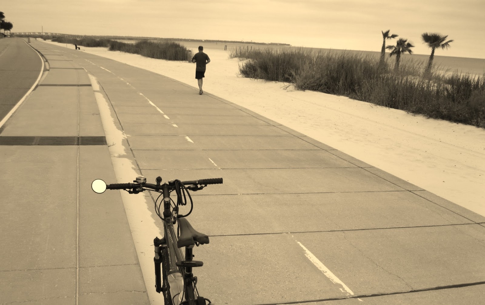 |
Looking east from wide concrete path between S. Beach St. and Mississippi Sound connecting Waveland and Bay St. Louis, Mississippi. The path is about four and one half miles long with parking at the Washington St. boat launch in Bay. St. Louis and the fishing pier in Waveland.
-30- |
The arrival of these occasional days of clear, crisp weather are an invitation to spend some time lazily bicycling through the coastal Mississippi towns of Bay St. Louis and Waveland. These two adjoining small beach towns fronting Mississippi Sound can be easily explored using self-propelled, two-wheel transportation. Almost all attractions; eateries, specialty shopping and museums in the two towns are within a few miles of each other and can be accessed using narrow but quiet residential streets or by riding a 4.5 mile paved path along the beach. Bicycling to the county's two casinos requires some cycling on two lane roads with moderate traffic.
But it's BYOB (Bring Your Own Bike) if you want to bicycle tour in Hancock Co. Fall is off-season so it will be hard to find a business renting bicycles there. Heck, its hard to find a bicycle to rent there in the middle of the popular summer season.
If you are comfortable riding with car traffic on a narrow two lane with no shoulders, check out Beach Blvd. From one end of the road at the mouth of the Jourdan River it's 12 miles to the Silver Slipper Casino overlooking the Sound. All along the way are a variety of marine vistas from the dunes tufted with sea oats swaying in the breezes to the wetlands alive with shore birds near the mouth of the river. This main road also fronts Buccaneer State Park with its popular wave pool. This is a great early Sunday morning trek.
The Bay-Waveland Beach Trail is a 4.5 mile paved path that parallels S. Beach Blvd. One end begins at the Washington St. Pier in Bay St. Louis. At 2.7 miles it passes the Waveland Pier and runs almost two miles past it west to a dead end. Join S. Beach Blvd. to continue riding west.
Take some time to get off the trail and ride up Coleman Ave. into "downtown" Waveland. Bay St. Louis and Waveland were ground-zero for the fury of Hurricane Katrina in 2005. A storm surge nearly three stories high came in from the Gulf of Mexico and smacked into the two towns. Buildings and homes were reduced to rubble and splinters-- many well inland from the shore--especially in Waveland. Note the large parcels of open land fronting S. Beach Blvd. Before August 29, 2005, there were homes on those lots.
An historic brick schoolhouse, the only building left standing on Coleman Ave. after the storm, has been restored and serves as a museum that tells the story of the storm and of the heroic effort of those living through it to rebuild the town. www.wavelandgroundzero.com/
Back in Bay St. Louis, make your way from from the Washington St. pier (boat launch, bathhouse and parking) to Depot Row on Blaize Ave. using Beach Blvd. and Union St. Across the street from the row of restaurants and shops is the historic L & N Railroad Depot. Built in 1928, the two story mission style depot was a busy place years ago when "The Bay" was a vacation destination for summer fun seekers from New Orleans, 60 miles to the west. Recently restored, the white depot with the hot pink trim, is now the home to the Depot Visitor Center and the Hancock County Tourism Development Bureau. Phone 228-463-9222 or 800-466-9848.
At the Depot you can find the Old Town Bay St. Louis Historic Walking and Biking Tour brochure, valuable for locating other attractions in Bay St. Louis.
Much of "This Property is Condemned," a 1966 movie based on a one-act play by Tennessee Williams, was filmed in Bay St. Louis. (A little of the movie was also filmed in New Orleans.) It featured a young Robert Redford and Natalie Wood in starring roles. Ask about the many buildings seen in the film that still exist. The Star Boarding House, featured in the film, has been restored and is now the home of the Bay St. Louis Little Theatre.
If your ride is on a Sunday check out the Jazz Brunch at LuLu Eats, 126 Main St., 228-466-6620. The live music packs the place on Sunday so call early to let them know you are coming.
-30-
Saturday, October 3, 2015
Possum Trail resurfaced with crushed stone yet still a hazardous bicycle ride
 |
The Possum Walk Trail, from the historic Logtown town site to NASA's Infinity Science Center, was recently resurfaced with crushed stone. The trail attracts birding enthusiasts from around the US. Next year visitors to the Science Center will have the option to explore the trail riding in electric trams. (Picture taken October 3, 2015)
|
(Note: The Roadkill Run scheduled for October 10, 2015 was cancelled.)
In Hancock Co. MS, the Possum Walk Trail opened over a year ago as a graded dirt trail connecting the cemetery at the historic Logtown town site with the parking lot at the NASA Infinity Science Center 3.2 miles to the northeast. To ready the trail for electric trams that will carry Science Center tourists on nature treks on the trail in 2016, work began resurfacing the dirt trail with crushed stone in September. By Oct. 3 the work on the trail has progressed to the point users are now allowed back on the trail, though a short stretch near the boardwalk at the Logtown end of the trail still needs to be graded and resurfaced.
While the dirt surface was fine for walkers, runners, equestrians and the occasional golf cart, the soft dirt made riding a bicycle on the trail dicey. Even bicycle wheels with fat tires would sink into the powdered dirt making it difficult to steer without falling. Bicyclists had hoped the new crushed stone surface would open the trail to bicycle use by providing a harder surface to ride on.
The new surface is worse than the dirt. The coarsely crushed stone sits loose, like gravel, providing less traction for a bicycle tire than the dirt. And falling on the crushed stone could be more painful than falling on the dirt.
Not only is the new stone surface a hazard to those on two wheels, the loose stone presents a risk to those on two feet. Hikers, walkers, and trail runners should be careful when treading the shifting stone surface. Eventually the crushed stone will be pounded into the dirt underneath by the tires of the electric tourist trams, (and other motorized vehicles using the trail), smoothing the surface. Until then footing on the loose rock is iffy. If planning to walk the trail, popular with birdwatchers, be sure to wear sturdy shoes offering good ankle support.
The trams themselves could be a hazard when they are introduced next year into the mix of trail users. A tram ride will be included with every admission to the Science Center--adults $12. The trail is not that wide. Trams will have to be equipped with a warning device to alert walkers who will have to move to the edge of the trail and walk single-file to allow the tram to pass. The trail may be wide enough for two trams to pass abreast but it will be a tight squeeze. Other trail users will probably have to step off the trail to allow room. And how often will the trams run?
-30-
Sunday, September 20, 2015
It's not official: The Lafitte Corridor bike path (New Orleans) is open
 |
| The paved path in the Lafitte Corridor as it crosses Jefferson Davis Parkway in New Orleans heading north. |
A 2.6 mile paved path passing through several neighborhoods between the French Quarter and City Park, is open.
The path runs through the Lafitte Corridor, a skinny park or greenway beginning at the north border of the French Quarter in New Orleans at Basin St. Station and ending at Alexander St. three blocks from City Park. There is parking at Basin St. Station but none at Alexander St.
Near the French Quarter the park is wide and there are ball fields and play areas near a public housing development. The corridor narrows after passing Broad St. The view of the derelict industrial area between Broad St. and Jefferson Davis Parkway is softened by freshly planted landscaping. There are lights along the length of the trail though some residents have lingering concerns about security.
Riders connecting the French Quarter with Mid-City and City Park also have the option of using the striped bike lane on Esplanade Ave. The striping stops about two blocks from the FQ leaving riders between a narrow traffic lane and solid on-street parking but there seems to be be more two wheel traffic using it than the Lafitte Corridor.
Maybe people don't know the Lafitte Corridor Tail is open. There has not yet been a ribbon cutting signaling the end of construction. yet people have been bicycling and walking it for about two months now. Almost every day or so workmen add something to it; a sign here, a fence there, a sprinkling of vegetation.
 |
| Can you find the blinking yellow lights? |
| Note: Expecting those little flashing amber lights to have any influence on the drivers traveling busy four and six-lane streets and avenues crossing the trail equals crazy here in New Orleans. As often noted in the Times Picayune, drivers here have long been proud of their reputation of ignoring crosswalks, striped or not. The amber flashing lights, (which, by the way, are hard to see in the daytime anyway) at the intersections of the trail and Carrollton Ave., Broad St., Jefferson Davis Parkway, Galvez St. and N. Claiborne are next to useless in stopping two or three lanes of approaching motorized traffic so you can cross. (Any driver stopping is probably from out of state.) Crossing the street when a car is coming is very dangerous. Wait until there is no traffic before crossing these busy streets. |
There is a deep crack on Broad St. a right angles to the path just as you come off the path heading north. It might spill a rider on a bicycle with skinny tires into traffic.
There is still landscaping work to do flanking the asphalt trail.
Several businesses of interest to bicyclists cluster near N. Carrollton. A high-end outdoor clothing retailer also selling camping gear and kayaks, sells bicycles and offers repairs. A bicycle shop, with an entrance off Toulouse St. backs up to the trail next to the post office. Neither shop rents bicycles. Two grocery stores with deli's and outdoor seating share the trail's property line.
Near the N. Carrollton intersection is a shopping center with a few trendy, inexpensive franchise eateries. (You can get your nails done too or buy a phone) You and your friends can celebrate your ride by having a burger, beer, tacos or frozen yogurt on the raised patio there.
-30-
Saturday, September 12, 2015
Bicycle/walking trail opens in rural Stone Co., MS
 |
| The ribbon cutting at the opening of the Old Wire Road Trail in Stone County, Mississippi |
Draped on a ridge separating the Red Creek and Tuxachanie Creek watersheds, the trail looks like it was built in the middle of nowhere; open fields and pine forests dotted with widely-spaced housing as far as the eye can see. When the trail comes to Evans Rd. in the west and O'Neal Rd. in the east, the pavement just stops. No parking lot, water fountains or restrooms like fancy multi-million dollar rails- to-trails conversions in the region such as the 28-mile Tammany Trace to the west in Louisiana or the 39-mile Longleaf Trace with its eastern terminus in Hattiesburg, MS, 30 miles to the north.
While few "serious" cyclists, capable of ripping along at 18-20 miles an hour, hour after hour, would consider the Old Wire Road Trail a "destination trail" like the Longleaf Trace or Tammany Trace trails, residents with property fronting the trail pushed for nearly six years to have it built. It is not in the middle of nowhere to them. They know exactly where it is. For many of them it runs through their front yards.
Speaking at a ribbon cutting ceremony to open the trail, September 5, 2015, Stone Co. Board of Supervisors president, Scott Strickland spoke to a crowd of about 40 of the county's residents, thanking property owners for agreeing to easements permitting the trail to cross their property eliminating the expense of having to purchase land for the trail.
The ceremony was held where Wire Road, City Road and Sunflower Road come together. Some in the crowd standing under a bright late morning summer sun held bicycles and were dressed ready to ride. Others patiently waited for the speeches to end before quickly retiring to the nearby air conditioned community center to refresh with bottled energy drinks and store-bought brownies.
Jon Bond, the county's engineer, said after the ceremony, he hoped the trail would become a catalyst, spurring development of projects to take advantage of a growing interest in the county as a destination for "eco-tourism." One example would be to extend the trail nearer to Ramsey Springs, fronting Red Creek, considered by many to be the best canoe camping creek in the Southeast. Last year the state of Mississippi acquired about 56 acres, some of it fronting Red Creek, at Ramsey Springs. The county paved a simple concrete boat launch at the site, but since then there has been little other development. Bond, an advocate for outdoor recreation in the county, said the property, upriver from where highway MS 15 crosses the creek, would be ideal for a nature trail.
Paddlers can also access Red Creek from the highway right-of-ways at MS 26 west of Wiggins, where there is a concrete boat launch, US 49 at Perkinston and where City Bridge Rd. crosses the creek at a small park with a concrete boat launch and a parking lot.
Bond, told the crowd the trail commemorates the first telegraph line to link New York with New Orleans, then the largest city in the South. Strung from pine trees in 1846, the line linked the Atlantic Coast with the Gulf Coast via Pensacola, FL. This vital communications link remained active until 1870 when a railroad was completed from New Orleans to Pensacola. Commemorative plaques along the trail explain the telegraph line and its importance.
Before the telegraph was perfected in the early 1840's, long distance communication was primitive. Messages to distant cities were carried by post riders on horseback in relays meaning that even in the best of circumstances, a message from New Orleans to New York could take weeks to be delivered. A telegram sent over the same distance required only a few minutes to send, Bond said.
Jamie Miller, executive director of the Mississippi Department of Marine Resources, told the crowd that the history of the telegraph through Stone County (in 1849 part of Harrison County) is a nationally significant story and that the trail will help tell it to residents and visitors. The DMR administers the Coastal Impact Assistance Program which provided the funding for the bicycling/walking trail.
The trail parallels E. Wire Road but is north that highway's right-of-way. Park at the community center at the intersection of City Rd. and Wire Rd. as there is no parking along the trail or at either end.
The light traffic and smooth surfaces make Stone County's back roads popular with bicyclists from the Mississippi Gulf Coast who train on the rolling terrain often. Residents report seeing cyclists, many in red Gulf Coast Bicycle Club (GCBC) jerseys, speeding in tight packs hunched over their handlebars in full tuck to take advantage of the wind shelter a pace line provides.
The area is a part of an annual rite of fall for recreational bicyclists. Sunday, October 4, 2015, The GCBC will hold the Southern Magnolia 100, a bicycle ride that attracts riders from across the Gulf South. Riders start from the Woolmarket neighborhood of Biloxi early in the morning choosing one of five distances--from 11 to 100 miles. The two longest rides come into Stone County; the 100 mile ride, aka "century," and the metric century, 62 miles. Volunteers set up rest stops to provide riders with snacks and fluids. While the event is not a real race, (the route is open to traffic and riders share the road with motorized traffic), the fastest riders, often riding light weight bikes not too different from the bicycles professional bicycle use, compete for bragging rights by trying to finish the 100 miles in five hours or less. But most will take longer.
A few miles south of the Old Wire Road Trail, a route linking back roads from San Diego, CA to St. Augustine, FL, has been used by bicycle tourists for more than a two decades. The 3,000 mile Southern Tier route, mapped by Adventure Cycling, a non-profit that has been developing long distance bicycle routes since 1976 when it was known as BikeCentennial, passes through the De Soto National Forest. The route is popular with cyclists looking for a challenge when it is too cold to ride in the rest of the country. Some speedy, well-heeled riders make the trip eating all meals out and sleeping in hotels, motels or bed and breakfast inns to save the hassle of pitching tents and cooking meals. But most travelers on the route are self-contained; hauling all camping and cooking gear on their bicycles or in lightweight trailers attached to the rear wheel. The trip from coast to coast takes from six to 10 weeks.
-30-
Monday, May 11, 2015
Bicyclist on St. Claude Avenue bridge busted for obstructing traffic
 |
| St. Claude Avenue Bridge, 9th Ward New Orleans, LA |
by Jack Curry Jr.
Each school day, twice a day, Laurence Kopelovitch, a 40-something school librarian crosses the narrow and heavily trafficked St. Claude Ave. bridge over the Industrial Canal in New Orleans as part of her bicycle commute and ferry ride to her job in Algiers, across the Mississippi River.
The French-born cyclist has lots of company. The area Kopelovitch lives, the Lower 9th Ward, has been slow to recover from the devastating flooding unleashed when the levees along the canal were breached during Hurricane Katrina. That was ten years ago, yet even now many residents there are forced to rely on walking or cycling for transportation as only half of those living within a five-mile radius of of the bridge have cars. A survey of bicycle/pedestrian traffic on the bridge by the University of New Orleans in 2012 found about 500 pedestrians and cyclists crossed the bridge the two days of the survey.
Riding a bicycle across the bridge is considered to be the most dangerous legal half-mile bike ride in the city, cyclists who ride it say.
Bridge is a white-knuckle experience for bicyclists
Thundering fleets of tanker trucks and other big rigs servicing chemical plants and other heavy industries lining the Mississippi River in St. Bernard Parish barrel across the bridge's narrow lanes. There is plenty of four-four-wheel traffic too. The bridge is part of LA 46, ( most commonly known at St. Claude Ave.), a major arterial highway connecting workers in the high rise office towers and hotels of downtown New Orleans with their homes in the historic working class neighborhoods downriver.
In an attempt to make life a little safer for two-wheelers using St. Claude Ave, the first designated bike lane in New Orleans was striped there in 2008. Three miles long and five feet wide the bicycle lane was striped in between the right traffic lane and the parallel car parking along the curb.
However at the narrow bridge approaches there is no room for it. The bike lane stops leaving cyclists to fend for themselves on a bridge just wide enough for car and truck traffic alone.
Bicycling the bridge's slender lanes with the noisy, rumbling stream of heavy traffic is a white-knuckle experience, cyclists say. Often trucks, buses and cars pass within just inches of bicyclists riding the bridge despite state law requiring drivers pass a cyclist no closer than three feet.
Cyclists face other hazards when crossing the 96-year-old-bridge. Traffic lights at the beginning of each bridge approach send traffic up the approaches and across the bridge in waves: fast and bumper to bumper one minute, empty roadway the next. At the bridge proper the roadway is a slick, steel grate patched with steel plate, a challenge wet or dry.
(Pedestrians use a three-foot wide walkway flanking the bridge but not the approaches. The elevated approaches to the bridge have no walkway. Pedestrians approach the bridge ground level accessing bridge traffic lanes by climbing several flights of narrow stairs at the levee. At the steel grating at the center of the bridge is a RTA bus stop and room for a bus to get out of the traffic lanes on the bridge.)
Kopelovitch accepts the risk and rides her bike near the middle of the right lane, a defensive position veteran cyclists call, "taking the lane. It forces traffic following the cyclist to move to the left lane to pass. This greatly lessens the chance a cyclist hugging the right side of the road of being hit by a driver trying to squeeze by in the right lane at high speed. Usually a few irate motorists honking their horns are the only problem. But one day in August of 2014, Kopelovitch's maneuver caught the attention of New Orleans police in a following squad car.
Bicyclist is pulled over by NOPD squad car
She was pulled over. Her ride resulted in a citation for impeding the flow of traffic on the bridge and additional charges for not wearing a helmet and not having a registration decal on her bicycle. If found guilty to all three she faced over $450 in fines. As if bicycling a half mile across the busy bridge with speeding trucks and buses passing within inches were not worrying enough she is now being told it is illegal and could be expensive.She wanted to fight the three charges, to be contested in New Orleans Traffic Court, but felt she needed help. Her appeal to BikeEasy, a local bicycle advocacy group, was referred to Charlie Thomas, a New Orleans attorney and Louisiana's member of BikeLaw.com, a nationwide network of attorneys representing bicyclists in court. I interviewed Thomas, April 21, 2015 about their day in court.
Going to traffic court
Kopelovitch's hearing was the afternoon of October 18, 2014 in Division C of New Orleans Traffic Court, Judge Mark Shea presiding. Before appearing before the judge Kopelovitch met with the city at attorney to determine how she would plead to the three charges. She was one of the few traffic court defendants to have an attorney.From the beginning Kopelovitch's session with the city attorney was tense, Thomas said. An adult bicycling without a helmet is not breaking the law in Louisiana but it took a computer search of Louisiana law to convince the city attorney to remove the charge, Thomas said. (Children aged 14 and younger, on the other hand, must wear a helmet according to state law.)
City attorneys meet with traffic court defendants prior to pleading before the judge to streamline the day's court proceedings and, from the city's point of view, to determine the strength of each case. At these brief sessions the city attorney may offer a defendant a chance to "plea down" violations to lesser charges with smaller fines. Or, in some cases, the city attorney can drop charges altogether.
Dropping the no helmet charge still left Kopelovitch on the hook for the two remaining violations and total fines of over $300. There are no lesser charges for impeding traffic or not having a bicycle registered with the NOPD. So the city attorney offered her a deal: plead guilty to not wearing a seat belt--only a $50 fine--and the impeding traffic and no bicycle registration violations would be dropped. Thomas said she looked at the city attorney incredulously and said her bicycle did not have a seat belt, how could she be guilty of not wearing one?
Thomas said the plucky Kopelovitch dug in her heels, refusing the offer. Bicycling on the bridge is how she goes to work every day. He said she worried that if she let the impeding traffic violation stand she, or any other cyclist, could be ticketed any time the police saw someone bicycling across the bridge.
Bicycling in traffic: It's complicated.
Cyclists in Louisiana are permitted to ride most all public roadways in the state--the Interstate Highway system is an obvious exception--but the law does not precisely define where on the roadway they must ride. "As far to the right as practicable," is how the law is written, but Thomas admits that where that is depends on where a judge decides it is.Thomas said Kopelovitch explained that she was riding as far to the right as she felt comfortable and that she knows what the laws are.
"If I was all the way to the right and two trucks were to pass me, there is probably a good chance I would be killed. The safest thing I could do was take the lane, which I have a right to do," Thomas said Kopelovitch told the city attorney.
At that point, Thomas said it was clear that Kopelovitch and the city attorney were at an impasse. The only option was to go before the judge and plead not guilty to the remaining two violations on the ticket and let the judge settle it.
"The city attorney was was not going to let her walk away and she was not going to plead to anything," Thomas said.
The two opposing attorneys chatted on their way to the courtroom. The city attorney admitted that he did not know how all the vehicle laws applied to bicyclists, Thomas said, but would press for a guilty verdict on the no bicycle registration charge--a fine of $154. The impeding traffic charge was still in play too.
Rescued by the US Constitution
As court was about to convene and everyone took their places, Thomas suddenly had a thought that might lead the city attorney to drop the no bicycle registration violation. His argument would hinge on a defense based on the Fourth Amendment of the U.S. Constitution, the so-called "illegal search and seizure" amendment in the Bill of Rights, a defense he learned in law school.In the few minutes before court was called into session Thomas continued to discuss the remaining two charges with the city attorney.
"Let's say you lose on pulling her over for impeding the flow of traffic. The police should not have stopped her to start with. She was riding on the bridge legally." Thomas argued. "It was only after the officer pulled her over to charge her with impeding traffic that he saw she had no bicycle registration sticker. He didn't pull her over because he saw her bicycle wasn't registered, she was pulled over because the cops thought she was impeding traffic, a charge we will prove she was not guilty of. So, the charge for not registering the bicycle is a violation Fourth Amendment guarantees against illegal searches, " Thomas said.
Thomas argued the evidence that Kopelovitch's bicycle was not registered--the cops seeing no registration sticker on the bicycle after the stop--was inadmissible in court because the officer's discovery was made after she was pulled over for what the police thought was a violation; impeding traffic. In this case the evidence collected after she was stopped (the cop saw no sticker on the bicycle) would not be admissible evidence in court because she was not legally impeding traffic in the first place, Thomas hoped to prove.
Thomas referred to a legal doctrine known in the U.S. by the metaphor, "poisoned fruit from a poisoned tree." It is described in a Wikipedia entry as "evidence obtained illegally." An illegal stop is considered in the metaphor a "poisoned tree." Evidence from that illegal stop would also be illegal (generally inadmissible as evidence) just as a poison tree would bear only poison fruit.
"After I spoke with the city attorney, he discussed it with the cop. They came back and said they were going to drop all the charges," Thomas said.
Minutes latter Thomas snapped a picture of a beaming Kopelovitch outside on the Municipal- Traffic Court steps flashing a peace sign.
Unfortunately not all bicyclists caught in the legal system escape with such a happy ending. The main issue is money, said Thomas, a native of New Orleans and a bicyclist since his teen years.
"If she had to pay an attorney by the hour to help her with that, the costs would have been ridiculous," said Thomas, who represented Kopelovitch pro bono largely out of sympathy for her plight.
"There is a definite need for legal services at the pro bono level helping bicyclists with issues that they encounter like those Laurence recently faced," Thomas said.

-30-
Note: Since this post first appeared May 11, 2015, it has been edited numerous times for clarity. The facts were not changed.Tuesday, April 21, 2015
Ideas sought at New Orleans bicycle advocacy forum
 |
| WELL I'LL BE DAN! Dan Jatres (l) Program Manager, Greater New Orleans Pedestrian and Bicycle Program, Regional Planning Commission (RPC) and Dan Favre, Executive Director for BikeEasy, a bicycle advocacy group in New Orleans, relax at the NOLA Bike to Work Week Community Forum April 21, 2015 |
Bicycling advocates, both professional and just interested folks, recently held a forum to discuss and plan what they would like the future of bicycling in New Orleans to be like. Of the four dozen or so advocates attending the meeting--one event in "NOLA Bike to Work Week" presented by Entergy, some were urban planners who contribute to the design and implementation of bicycling facilities, others were paid heads of cycling advocacy groups and some were volunteeers in those groups. There were a sprinkling of city government representatives. But many sitting on the hard plastic chairs behind folding tables topped with maps, pens and colored markers, in the Sojourner Truth Neighborhood Center near Treme, had no skin in the urban planning game other than just wanting to contribute their say about the cycling life in the Crescent City now. Like Dean Gray. Speaking for stolenbikesnola, a Facebook site dedicated to combating the recent rash of bicycle thefts in the French Quarter, Gray rose to speak late in the meeting to encourage those who have had their bikes stolen to file a report with the police.
"The police will not press charges if there is no police report, even if the bicycle is recovered," Gray said.
Pictures of stolen bikes posted on Facebook, a social media site, has led to the recovery of some of them. But if there is no police report with a bicycle serial number there is very little the owner of the stolen bike can do to prove the bicycle is his.
Filling out a report requires a visit to the district police station in the district the bike is stolen but the report is easy to fill out and the officers in the Eight District, where most of the thefts are now occurring, are very helpful, Gray said.
Grey, who said he became interested in the issue when thieves stole a bike he gave to his girlfriend, strongly advised riders not to rely on cable locks, which can easily be cut with bolt cutters, to prevent bicycle theft. Instead use stronger, more resistant to cutting and more expensive, "U" locks. Also when locking a bicycle, carefully inspect what you are locking it to. To steal bikes in New Orleans, thieves have cut metal sign posts, like the metal posts with parking regulation signs, from their concrete bases then reinserted the posts into the ground using easy to remove PVC pipe sleeves. Gray said he found six posts in the French Quarter that have been altered in this way.
The meeting opened with a brief but wide-ranging panel discussion of where bicycling is now in New Orleans and where it should go. The group then broke up into smaller discussion groups which presented the fruits of their discussions at the end of the evening on big sheets if butcher paper taped to the wall.
The panelists were Eric Griggs, M.D., Rachel Heiligman of Ride New Orleans, Jennifer Ruley, with the Louisiana Public Health Institute and Charlie Thomas, from Bike Law Louisiana. The panel moderator was Sophie Harris of the Friends of Lafitte Corridor.
The welcome was given by Dan Favre and Jamie Wine. Favre, on the job as BikeEasy's new executive director for a whole seven days, told the group that while much had been done, there "is a long way to go."
Speakers touted the nearly 100 miles of bicycle routes now in New Orleans. Charlie Thomas, a lawyer who defends cyclists in court told the group two cautionary tales of what cyclists might expect when seeking a court remedy. (What Thomas said will be the subject of a future post.)
-30-
Wednesday, April 1, 2015
Lafitte Corridor path opening delayed till summer
 |
| Construction continues at the intersection of the Lafitte Corridor recreation path and N. Carrollton Ave. Completion of the 2.6 mile path connecting the French Quarter in New Orleans and City Park is now set for early summer 2015 |
 |
| When the bike path opens, riders will have access to this bicycle workstation complete with air pump near N. Carrollton Ave. |
When complete the paved path will connect Basin St., the northern boundary of the French Quarter with N. Alexander St., a street leading to the City Park Ave. entrance to City Park two blocks away.
In the Treme neighborhood, near the F.Q., the corridor is wide with space for developed ball fields and recreation areas. As the corridor moves northwest it narrows containing only the 12 foot wide path.
The park was to open in the late winter of this year but apparently the addition of a new bridge over a drainage canal and other items added after construction began delayed the project.
-30-
Saturday, October 4, 2014
Lafitte Greenway (New Orleans, LA) progress report
 |
| The Lafitte Corridor Bicycle and Pedestrian Path looking towards Broad St. from Jefferson Davis Parkway. The path and surrounding park linking Mid-City with the French Quarter is set to be completed in the spring of 2015. Residents and commuters are asked not to use the trail until it is officially opened. |
The Lafitte Greenway Bicycle and Pedestrian Path, now under construction through the neighborhoods of Treme and Mid-City will open on schedule in the spring of 2015.
New Orleans Department of Public Works construction project manager Louis Haywood assured a small group attending a Lafitte Greenway Expo at the restored Carver Theatre in Treme recently, that the park and path, "will be open by Jazz Fest."
Construction on the project began in March of 2014.
The 2.6 mile asphalt path connects Basin Street bordering the French Quarter (New Orleans) with N. Alexander St. near N. Carrollton Ave. to the northwest. The path is 12 feet wide and most of it straight as an arrow. The project also includes new ball fields in Treme, grading and replanting of meadows, landscaping and tree planting.
The end of the path at N. Alexander St. is about three blocks from the south entrance to City Park on City Park Ave.
The trail will be lighted and open 24-hours. Security arrangements for the park and trail, which will open in about six months, are being discussed, Haywood said.
The trail intersects several four-lane streets. Haywood said drivers approaching those crosswalks will be warned of crossing pedestrians and cyclists by a state-of-the-art flashing light warning system similar to the flashing lights on emergency and police vehicles. Trail users activate the warning lights by pushing a button at the side of the trail. The lights come on immediately after the button is pushed. This system of warning lights debuted in Florida recently and were very effective in stopping automobile traffic, Haywood said.
The crosswalks will be striped with white "zebra stripes" much larger than those seen at crosswalks in the city now. Pedestrians have the right-of-way at crosswalks.
To facilitate traffic on the path which shares the right-of-way with St. Louis St. for a few blocks, St. Louis St. will become one-way lakebound from N. Carrollton Ave. to Soloman St.
Residents and commuters must stay off the path until it is officially opened as it will be an active construction site until that day and is dangerous, trail officials said. To keep sight-seers out, the pedestrian bridge at Lopez St has been closed. It will be replaced with a new bridge when the path and park open, Haywood said.
Plans for the Lafitte Corridor path call for it to be extended to Canal Blvd. in lower Lakeview. However that half-mile or so of right-of-way is still an active railroad spur and not now available for path development.
Opening the path next spring should make the city's growing number of bicycle commuters happy. New Orleans is ranked fifth in the nation in bicycle commuting, said Naomi Doerner, executive director of BikeEasy.org, a bicycle advocacy group in New Orleans. In the years between 2010 and 2012 bicycle commuting in the city increased 200 percent, she told the group at the expo.
For more information contact the Department of Public Works at (504) 658-8046 or by e-mail crobles@nola.gov. Contact Friends of Lafitte Corridor at www.folc-nola.org.
-30-
Tuesday, September 9, 2014
New Orleans ranked #22 on Bicycling magazine's list of America's Best Bike Cities
 |
| A sharrow in the right travel lane heading to the French Quarter of Orleans Ave. in New Orleans |
For the year 2013, New Orleans is ranked #22 on Bicycling magazine's 50 top cities for bicycling in the U.S. The magazine ranked the city 43 in 2012. Number one for 2013 was New York City.
The rankings boost for New Orleans is attributed to the expansion of the city's bicycle network from about five miles to nearly 100 miles since Hurricane Katrina nine years ago, the magazine editors say in a blurb in the October 2014 edition of the magazine.
(As reported in the Times-Picayune November 7, 2014, the city had 37 miles of dedicated, on-street bike lanes and 16.5 miles of off-street paths. The city has 40 miles of designated "shared" lanes.
Shared lanes are traffic lanes marked with "sharrows", arrows and a bicycle glyph painted white on the roadway. Some have signs too. Shared lanes do not exclude motorized traffic. Shared lanes offer little or no protection to cyclists because drivers follow the suggestion of sharing the lane with cyclists only if a driver wants to. Many city streets with shared lanes carry heavy traffic. Shared lanes are used on such busy city arteries as City Park Ave. leading from under an Interstate interchange to Delgado Community College and east bound Orleans Ave. a four-lane street leading to the French Quarter.)
However, infrastructure improvements over the past several years not mentioned in the magazine's appraisal do boost the city's reputation as a bike friendly town. About two miles of Esplanade Ave. from City Park to Claiborne Ave. was resurfaced and restriped converting the narrow four-lane into one wider traffic lane and one bike lane in each direction. This has become the main route used by cyclists traveling from the French Quarter to Lakeview and City Park. (Cyclists must still negotiate a half-mile stretch of Esplanade riding in a narrow traffic lane between N. Claiborne and Rampart St. at the edge of the French Quarter.)
Last year the bike path along Lake Pontchartrain in Jefferson Parish was finally finished after about 35 years of on and off construction and partial closings because of levee and pumping station construction. Riders can now ride the entire 10-miles from Bucktown at the 17th Street Canal separating the parishes of Orleans and Jefferson west to Kenner without having to detour or leave the path for any reason. The ride can be extended two miles (one-way) by turning south at the end of the path in Kenner onto the broad concrete service apron at the base of the storm wall along the Jefferson/St. Charles parish line. This path dead-ends at a pumping station. Until completion of an underpass at the Causeway Bridge last year, causeway traffic served as a de facto barrier separating the trail into east and west sections. Cyclists and pedestrians would have sprint across six lanes of busy highway traffic to complete their trips on the path.
(While that path is not in New Orleans it is very popular with riders from New Orleans who ride it regularly and its existence contributes much to the cycling climate of the area.)
To be completed in the spring of next year is the Lafitte Corridor multi-use path and playground, from N. Alexander St. near N. Carrollton Ave. to Basin St. Construction of the path is well underway with the blacktop down in some sections.
 |
| A view of the path under construction in the Lafitte Corridor in New Orleans taken 09-11-2014. The view is looking southwest towards N. Carrollton Ave. from N. Scott St. Rouses is on the left. |
-30-
Sunday, June 15, 2014
Algiers/Canal St. ferry to expand weekday hours
(This rewrite corrects the date new weekday service hours go into effect on the Algiers Point/Canal Street passenger ferry.)
Passenger ferry service across the Mississippi River connecting Canal St., downtown New Orleans, to Algiers Point will expand weekday service in July. The announcement was made in a press release posted on NOLAFerries.com, a website of the Regional Transit Authority (RTA).
The ferries are managed by Veolia Transportation Services, a French company hired by the RTA to manage the city's buses and streetcars.
Beginning Monday, July 21, 2014, ferries will run weekdays from 6 am until 10 pm. Saturday/Sunday schedules were not changed. Fares remain at $2 each way. Check NOLAFerries.com for exact departure times.
The Algiers Point/Canal St. ferry does not take cars but does accept bicycles and small motor scooters. (If you have a motor scooter check the long list of rules before attempting to board the ferry with your scooter.) The Chalmette ferry downstream accepts cars and larger motorcycles.
Other changes and proposed changes are:
- beginning July 1, monthly, ferry-only, passes will be sold for $65. These are good for unlimited rides in the month they are punched.
-Drop boxes will be installed to allow passengers to pay fares without employees having to take cash. Fares must still be paid in cash and no change is given. Later in the year passengers may be able to use automated fare cards.
- In September fares will be integrated with bus and streetcar service. Now, transfers bought on a streetcar or bus are not valid for the passenger ferry.
-A passenger ferry from Washington could be transferred to the ferry fleet in New Orleans pending approval by the Maritime Administration, a federal agency.
Cyclists have the option of using RTA buses to cross the river via the Crescent City Connection bridge but the trip takes much longer than the ferry crossing and the bus schedule does not offer many trips. Bicycle riding is not permitted on the Crescent City Connection.
The changes were announced June 12 at a meeting of the Algiers Point Association. The group has been fighting the deep cuts in the ferry schedule taken last summer after tolls on the bridge, a major subsidy for the ferry, were eliminated. The ferries had been run by the Louisiana Department of Transportation and Development before being taken over by the RTA.
Currently, the last ferry boats leave Canal St. for Algiers at 6:30 pm (8:00 pm on Friday and Saturday nights). This is too early for service workers without cars living in Algiers to return from their late shifts in French Quarter bars, restaurants and hotels, via the ferry, forcing them to either endure a lengthy bus ride or pay for taxi service.
Business at some bars, restaurants and bed and breakfast inns in Old Algiers has also been hurt. The ferry, which used to run until midnight, eliminated the necessity to drive across the bridge after a night out on the town. Especially popular with out-of-town visitors staying in Algiers was the chance to walk to and from the French Quarter without the hassle of crossing the bridge and finding a place to park in the crowded and world-famous New Orleans entertainment district.
Bicyclists ride the ferry to the West Bank to explore the historic neighborhood of Algiers Point.
-30-
Friday, April 11, 2014
Take your bicycle on the Mississippi River ferry to Old Algiers Point and enjoy a little jazz with your weekend breakfast
 |
| Roy and Bill, (Roy is on the right), set up for a photo shoot promoting their regular Saturday and Sunday morning performances at tout de suite, a coffee house and cafe in Old Algiers Point across the Mississippi River from New Orleans, LA. |
This post is an update of the 4-25-12 post titled "Bicycle to Breakfast in Algiers (New Orleans)
I am again comfortably numb. Paralyzed by relaxation. This happens every time I bicycle the few miles from the go-go 24/7 party city of New Orleans to the laid back neighborhood of Algiers Point. Taking the passenger ferry across a churning brown Mississippi River, and plunking myself down at a two-top covered with a red and white checked tablecloth outside tout de suite, a coffee house and cafe at the quiet corner of Alix and Verret in the historic district just does this to me. Eighty-six reality, at least for a little while, while I drift in a caffeinated haze.
A bright sun rising in a cloudless pale blue sky warms my bones while I enjoy my mid week, mid-morning reverie. Every fifteen minutes I hear from across the street, a loudspeaker hung on the outside of the the massive Tudor-Gothic brick bell tower of Holy Name of Mary Catholic church broadcasting a reasonable rendition of London's Big Ben chiming. Locals say it has been decades since actual bells in the belfry of the church, built in the 1920's, pealed the time.
Few other distracting noises intrude. This is not a busy corner, where Verret and Alix streets cross. There is no need for a traffic light, just a stop sign.
My wandering gaze lights on matching brown bicycles with fenders, fat tires and baskets locked to a bike rack shaped like a Celtic Cross a few feet away. Cute. I peer through the large place glass window into the cafe half-full with customers. Wood all around, dark and exposed. Kind of funky, really, but most of the art by local artists that had hung on these dark walls is gone. A recently opened community art gallery nearby displays those pictures now.
I write a blog about the outdoors. Sitting here, having coffee at a table in front of a coffee house and cafe, in the sun, I am outdoors. I am at work.
I break my vacant, 2,000 yard stare to begin a conversation with a cheery middle aged woman wearing an apron busily loading stuff from the cafe into a station wagon at the curb. She is Jill Marshall, owner of the tout de suite, a business she started ten years ago. As soon as she accepts my invitation to chat, she sits down and begins to tell me about changes in her cafe's menu offerings to better reflect the cultural influences that have swirled through the cooking of Old Algiers for centuries. Her face lights up as she highlights the changes.
"Huevos rancheros, the best in the city, reflect the Spanish influence of the 18th century," she said. Old favorites rooted in country French cooking that are popular have been retained. The Atchafalaya, eggs topped with crawfish etouffee, and the definitely French pain perdu, an almond crusted brioche with seasonal fruits and berries, continue to satisfy. The menu is diverse. Soups, sandwiches, entree salads, desserts. You want to come to tout de suite hungry. Basic breakfast noshes are available and their coffee is certainly good but the reputation of tout de suite is built on their skilled and inventive kitchen.
The thing about this place is that people go there to eat. They order at the counter, sit down and are served and they stay to eat their food. Not so much do people rush in to grab a cup of coffee and walk out the door sipping it as they talk on their iPhones on their way to somewhere else. This IS the destination.
Local products such as Steens cane syrup are featured. Pies and cookies are house made and there is an organic cereal offering on the kid's menu. Non-carnivores will find plenty on the menu to suit them from wild mushroom macaroni with four cheeses to quinoa patties. (The complete menu is at www.toutdesuite.com.)
Moving away from food I quizzed her about how the reduction in ferry hours has affected her business. The ferry had always appealed to Algiers Point visitors, offering a quick and convenient connection with the French Quarter without having to drive over the Mississippi River bridge.
But that was when the ferry ran from early in the morning to nearly midnight. Now the schedule is a fraction of that. During the week service ends about the time people get off from work and is of little use for anyone with an early morning schedule. The weekend schedule has been similarly gutted.
She said while there may be fewer tourists having breakfast in her place (Sunday, the first ferry does not leave the Canal Street ferry dock until 11 am), she now serves more locals on weekends who would have otherwise crossed the river to breakfast in the French Quarter.
"It has been kind of a wash," she said.
Live jazz music packs the place Saturday and Sunday mornings beginning at 9 am so I asked her if those staying in New Orleans miss out on the live music at tout de suite because of the late morning ferry schedule.
"Oh no. They play until noon," she said. As if on cue, the duo of Roy and Bill, who play at those jazz sessions, began to set up a photo shoot behind us at the curb on the corner.
All too soon my coffee cup is empty so it's time to leave. I thanked Jill for the conversation and started to ride my bicycle back to the ferry, a grueling six tenths of a mile.
 |
| Pelican Gulf gas station c. 1929. Closed in 1990 and reopened as Gulf Pizza. (504) 373-5379. |
While Algiers Point was settled within months of when New Orleans was founded in 1718, the historic district of Algiers Point looks like a village from the late 19th century. This is because most of the homes were built about that time after a disastrous fire destroyed most of the existing housing stock.
The historic area is small, bounded by the curve in the river and Atlantic and Newton streets. However most of the good stuff is clustered within a six or seven block radius of the ferry landing. Just let yourself wander around and soak up the vibe.

The first weekend in October, Gretna is home to one of the largest music festivals in the area, Gretna Fest.
Heading east (downriver) from the ferry landing, the path runs for another mile and a half before it deadends at Merrill St. Other than views of river traffic and industrialized St. Bernard Parish on the far bank there is not much to see. But the path does pass in front of the Old Point Bar which offers an extensive music schedule packed with local bands. (Riders can come off the levee and ride Patterson Road to the Chalmette Ferry and cross over to St. Bernard Parish. But riders exit the ferry onto a narrow two-lane with heavy traffic surrounded by large chemical plants and shipping interests. Not a recommended ride.)
Both paths have historical plaques installed at ground level. You may have to look for them but it is worth the effort as they give an idea of what was here before. Across the street from the ferry landing is The Dry Dock Cafe, www.thedrydockcafe.com. The cafe/bar, popular with locals and tourists alike, offers lunch and dinner seven days a week. Around the corner on Pelican St., a weekly quiz night at The Crown and Anchor, www.crownandanchorpub.com, keeps patrons entertained.
If walking or riding at night at Algiers Point, use common sense to keep safe, especially after dark. Don't venture far from from the ferry landing and stick to areas that are well lighted. Always be aware of your surroundings and maybe wait until you are back on the ferry before blocking your hearing with headphones.
Boarding the ferry, I met the riders of the matching brown bikes with baskets I saw at the cafe. A young couple visiting from Seattle, they said they rented the bikes and that they loved the food at the cafe. The fare for the ferry trip, $2 each way was a bargain for them as they pay more than that for bus fare they said.
As I walked my bike up the ramp at Canal Street I glanced down river to see workers setting up for French Quarter Fest. With opening day tomorrow, workers were busy pitching the food tents and building the stages. Only Mardi Gras attracts more visitors to New Orleans than French Quarter Fest, a music festival featuring only local performers. The "free" festival (this year attendees will be searched at check points around the festival perimeter to make sure they do not smuggle in food or drink) now draws more people than Jazz Fest.
I can only imagine what the crowds will be like when Dr. John takes the stage Friday night. Probably a lot like Mardi Gras, only warmer.
For more information visit www.algierspoint.org.
-30- .
Sunday, April 6, 2014
Bike to Work Day in New Orleans set for Tuesday, April 8, 2014
Scheduled for April 8, Bike to Work Day in New Orleans was postponed one day because wet weather was forecast for the morning of April 8. It was held the following day, April 9, a day of brisk winds, morning temperatures in the low 60's and brillant blue skies.
There seemed to be a smaller turnout this year than last year. Participants gathered on the Camp St. side of Lafayette Square Park around two tents: One with breakfast of huge fresh muffins and Community coffee and a second tent for recruiting new Bike Easy members, the non-profit bicycle advocacy group holding Bike to Work Day. Entergy is a major sponsor of Bike to Work Day and Patty Riddlebarger, the Director of Social Responsibility for Entergy Corp. was there chatting up bicycle commuting participants.
If bicycling to work is on your bucket list, Tuesday, April 8 is the day to make it happen. After your pedal into the city, join dozens of like-minded bicycle commuters after their ride into town for coffee and breakfast, 8:00am to 9:30am, in Lafayette Square Park in the CBD. Riders can ride solo or join groups leaving at 7:30am for the ride to the square
from about half a dozen neighborhood staging areas in Mid-City, Lakeview, Uptown, the French Quarter and the Marigny.
The ride is a project of Bike-Easy, a non-profit bicycle advocacy organization. The event is sponsored by Entergy and is free. For more information and a map of the neighborhood staging areas visit bikeeasy.org.
There seemed to be a smaller turnout this year than last year. Participants gathered on the Camp St. side of Lafayette Square Park around two tents: One with breakfast of huge fresh muffins and Community coffee and a second tent for recruiting new Bike Easy members, the non-profit bicycle advocacy group holding Bike to Work Day. Entergy is a major sponsor of Bike to Work Day and Patty Riddlebarger, the Director of Social Responsibility for Entergy Corp. was there chatting up bicycle commuting participants.
-30-
If bicycling to work is on your bucket list, Tuesday, April 8 is the day to make it happen. After your pedal into the city, join dozens of like-minded bicycle commuters after their ride into town for coffee and breakfast, 8:00am to 9:30am, in Lafayette Square Park in the CBD. Riders can ride solo or join groups leaving at 7:30am for the ride to the square
 |
| Bike to Work Day in New Orleans, 2012 |
The ride is a project of Bike-Easy, a non-profit bicycle advocacy organization. The event is sponsored by Entergy and is free. For more information and a map of the neighborhood staging areas visit bikeeasy.org.
Thursday, March 27, 2014
Canal St.-Algiers Point ferry service cuts trips, charges $2 fare each way
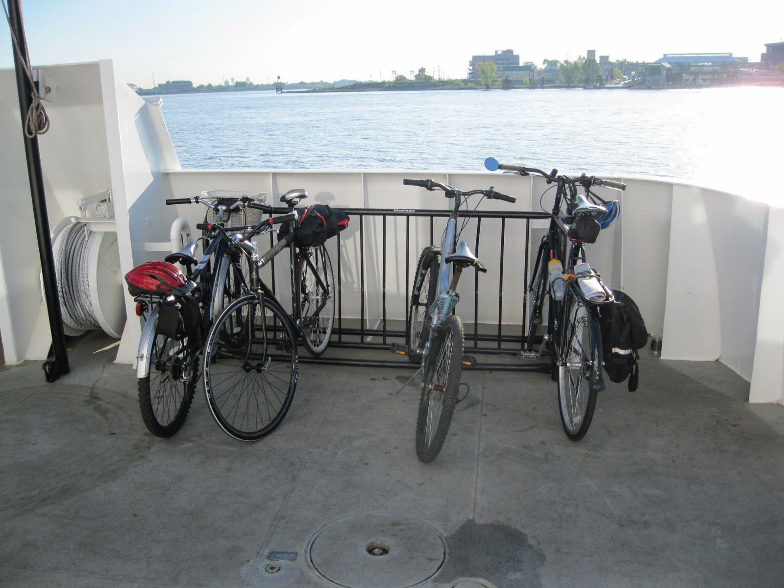
The free trip across the river offered the best views of the New Orleans city skyline and in summer the often breezy mini-cruise offered a way to beat the tropical heat of a summer's evening.
The views and the breezes are still there, but drastic cuts in ferry service hours and the establishment of a $2 fare, each way, has changed the way this sublime amusement is appreciated by the cult of the self-propelled. Gone are the days when, broke and on a whim, you could visit Algiers to sight-see, groove to a festival or compete in quiz night at a cozy Algiers Point bar knowing that unless you stayed way past your bedtime, a ferry would be there to bring you to your home across the Mississippi.
Now, visiting Algiers as a pedestrian or bicyclist via the ferry requires a willful decision and a working knowledge of the ferry schedule to void being stranded for the night on the wrong shore.
Here is that all important schedule, from the nolaferries.com web site. During the daily ferry schedule, ferries leave Canal St. every 30 minutes: on the hour and on the half hour. Ferries leave Algiers Point a quarter (15 minutes) before the hour and a quarter (15 minutes) after the hour. The trip takes about five minutes. No food or drink is available on the ferry or at ferry terminals.
Monday-Thursday: The first ferry of the day leaves Algiers at 7:15 am. It arrives at the foot of Canal St and leaves for the return trip to Algiers point at 7:30 am. The last ferry leaves Algiers at 6:15 pm. The last ferry leaves Canal St. at 6:30 pm.
Friday: The first ferry leaves Algiers at 7:45 am. The first ferry leaves Canal St at 7:30 am. The last ferry leaves Algiers 7:45 p.m. and the last ferry leaves Canal St. at 8:00 p.m.
Saturday: The first ferry leaves Algiers at 10:45 am and the first ferry leaves Canal St. at 11:00 am. The last ferry leaves Algiers at 7:45 p.m. and the last ferry leaves Canal St. at 8:00 pm.
Sunday: The first ferry leaves Algiers at 10:45 am. The first ferry leaves Canal St. at 11:00 am. The last ferry leaves Algiers at 5:45 pm and the last ferry leaves Canal St. at 6:00.
The ferries are fairly reliable but if the river is foggy, they ferries stop running. Board the ferry by walking your bike to the ferry outside the terminal on the metal grate down to the ferry. DO NOT RIDE YOUR BIKE ON THE METAL GRATE!
(Note: Veolia Transportation, the private for-profit company hired by the New Orleans Regional Transit Authority (RTA) to run the city's buses and now the pedestrian/bicycle ferry at Canal St. and the car ferry downriver at Chalmette, extended ferry operation hours considerably to accommodate Mardi Gras revellers. It might do the same for other large events such as the French Quarter Festival and Jazzfest. Log on to the NORTA site: www.nolaferries.com for the latest schedule changes.)
In late February of this year, pedestrians, bicyclists and scooter drivers began to pay a $2 fare for a one-way trip. Have correct change, each way. Cars are no longer carried on the ferry. Even though the ferry and the buses and streetcars are now managed by the same agency, bus/streetcar transfers are not valid for ferry trips. (Because of the narrow passageways on the passenger ferry, no motorcycles are allowed on the ferry; only scooters.) Pets are OK.
You don't have to be a rocket scientist to figure out that even with the slightly extended ferry scheduling on Friday and Saturday nights sampling the nightlife of one side of the river if you live on the other and depend on the ferry for transportation is not in the cards.
But if after a night of too much fun you find yourself stuck on the wrong side of the river after the ferries shut down for the evening, it's not the end of the world. You can take the bus. The RTA bus crossing the river to New Orleans from Algiers is the 101 Algiers Loop bus. The bus stop closest to the ferry landing is at the corner of Verret and Pelican and the last bus leaves at 9:49 pm. (There is an old abandoned Gulf service station at that corner.) The fare is $1.25. The trip takes about 30 minutes and arrives at Elk Place and Canal St.
Each RTA bus has a bicycle rack that holds two bicycles on the front of the bus. First come, first serve. You load the bike yourself. No extra charge for the bike. Visit the RTA web site at www.norta.com for instructions on how to load your bicycle on the bike rack on the front of the bus.
The bus stop at the ferry landing is for the 106 Algiers Local. Do not take this bus. It does not go to the East Bank and New Orleans. It just makes loops around Algiers on the West Bank.
Missed the bus? Time to call a taxi. Make sure the taxi service knows you have bicycle you want to bring. The trip will not be cheap but it will be cheaper than spending the night in a bed and breakfast waiting for ferry service to resume in the morning. Either way, next time you will pay more attention to when your ship leaves the dock.
-30-
Tuesday, March 25, 2014
Construction on Lafitte Corridor bicycle path (New Orleans) begins
 |
| Six shovels at the ready ten minutes before the ceremonial groundbreaking, March 25, 2014, for the Lafitte Corridor bicycle trail. The paved trail, 12 feet wide, will connect Basin St. at the north border of the French Quarter in New Orleans, with N. Alexander St., near City Park, a distance of 2.6 miles. The project, which in addition to the path will include playing fields and a large tree planting, will cost $9.1 million. It is expected to take 11 months to construct. |
Wednesday, March 19, 2014
Paved rail/trail across AL/GA one of the longest in USA
 |
| The end of the Silver Comet Trail and the beginning of the Chief Ladiga Trail at the GA/AL state line. |
The closest trail head to New Orleans is Anniston, AL. (The trail ends right at the city's border with Weaver. There are plans to take the trail into Anniston to the Amtrak station, about seven miles south of the trailhead.)
In Georgia, milepost 0 is the Mavell Road Trailhead in Smyrna.
Michael Tilley, 38, a bicyclist from Baton Rouge with 15-years of in-the-saddle experience rode the two trails end to end and back in the spring of 2013. He took a leisurely approach taking four days to complete the ride averaging about 50 miles a day. He stayed in motels along the way. The first section of the trail opened 20 years ago but is well maintained and mostly smooth, Tilley said.
NOTE: CONSTRUCTION ON THE TRAIL IN COBB COUNTY GEORGIA, THE EASTERN-MOST GEORGIA COUNTY THROUGH WHICH THE TRAIL RUNS, WILL CLOSE SECTIONS OF THE PATH UNTIL SEPTEMBER OF 2014. THERE ARE NO DETOURS. BE SURE TO GET THE LATEST CONSTRUCTION INFO BEFORE MAKING THE DRIVE UP THERE TO DO THE RIDE. THERE APPEARS TO BE NO CONSTRUCTION PLANNED FOR THE CHIEF LADIGA TRAIL IN 2014.
Talking trail with Tilley reminded me of my excursions to the trail several years ago. Using several out-and-back day trips, I covered the trail from just south of Jacksonville, AL, east to the Powder Springs trailhead in Georgia, a total one-way distance of about 80 miles.
Chief Ladiga Trail rolls north from Weaver, AL through a mix of farms, apartment houses and woods. At Jacksonville the trail passes near the campus of Jacksonville State University, a major supporter of the trail. Downtown Jacksonville (food, lodging) is about a half a mile east of the trail.
This area was first settled before the Civil War but landmarks commemorating that history are hard to find.
As you ride north from Piedmont the vista changes as riders approach the foothills of the Appalachian mountains in the distance. The total gain in altitude from Anniston to the AL/GA line is only about 250 feet and any ups and downs on the trail are tamed by the trail's 2% grade.
After Piedmont, the trail passes through the Talladega National Forest as it climbs gently beside Little Terrapin Creek to meet Georgia's Silver Comet Trail at Esom Hill at the state line. The trail very gradually drops to Cedartown, GA. This is a remote 24 miles so be sure to stock up with water and snacks before leaving either Piedmont or Cedartown to ride this section.
The trail follows the railroad grade through the highlands to spare riders from extreme climbs and descents with one exception: Cedartown and Rockmart. Here the trail veers away from the railroad right of way forcing riders to negotiate steep climbs and hair raising downhills requiring excellent brakes. One treacherous descent ends with a hard turn.
The high point of the trail is in Georgia: EL 1092 near Dallas, GA.
East of this, the trail returns to the fairly flat railroad grade for the trip east to Smyrna, GA, the eastern terminus of the trail. Smyrna is part of the urban sprawl extending at least 25 miles north of Atlanta, and Tilley reports that the trail can get busy as it nears Smyrna and the Atlanta megaplex.
(Getting to the trailheads near Smyrna from most anywhere in Atlanta can be time consuming because of the crowded highways connecting Smyra with Atlanta. Allow plenty of time for this connection.)
Flatlanders from Louisiana will enjoy riding through the Brushy Mountain Tunnel, 800 feet and 68 degrees all summer long. Trailheads with restrooms, parking and picnic tables appear to be more numerous on the Georgia trail.
The Rockport downtown has seen better days, and the trail passes through an iffy neighborhood in Cedartown so be sure to have a bike lock and park your bike where you can see it when off looking for a place to stay or somewhere to eat.
Tilley said reserving rooms for motels along the route was easy. But cyclists looking for a place to camp may have a harder time finding a place to stay. In Alabama, call recreation centers in Piedmont and Jacksonville to see what camping is being offered to trail users. There are no developed campgrounds in the Talladega NF near the trail put camping is permitted in most of the forest. Chief Ladiga Trail cross the Pinhoti Trail but no bicycles are permitted on that trail.
In Georgia riders will find a full-service private campground, "The Rock" a few miles east of Rockmart. The site also offers a primitive camping area and also some inexpensive primitive cabins. The private campground is ground zero for many concerts and large gatherings. Be sure to check their schedule to avoid crowded conditions. That is, unless someone you want to hear is performing.
There is a primitive campground on the Silver Comet Trail that does not show on the map. Good luck in finding out about that.
You can learn more about hometown boy Sterling Holloway, a film star from back in the day, than you ever wanted to know at the restored railroad station, that also serves as the town's visitor center, on the trail at Cedartown. There is a full service bicycle shop at the Powder Springs, GA trailhead that rents bicycles. In Anniston try Wig's Wheels, 256-237-9447.
Because Amtrak operates stations with baggage service in both Anniston and Atlanta it is tempting to want to use the train for a shuttle. The train schedule is OK: leaves Anniston heading east to Atlanta late in the day. The train station in Atlanta is downtown and just too far away from the Smyrna trailhead to make the shuttle practical. But having to buy a box for your bike and taking the time to pack it, not counting the distance of the stations from the trailheads might encourage you to think twice about using Amtrak as a shuttle right now.
FOR MORE INORMATION:
www.silvercometga.com
www.chiefladigatrail.com
www.therockrvpark.com camping near Rockport, GA
www.piedmontcity.org or Jack Holder at the Eubanks Welcome Center in Piedmont, phone 256-447-3363. You might be able to get a shuttle.
-30-
Subscribe to:
Posts (Atom)